
Pennant Hills and Beecroft, NSW
Pennant Hills and Beecroft are neighbouring suburbs on the Northern railway line, about 20 kilometres north-west of the centre of Sydney. Both are leafy and residential, with tall trees, old houses and village-style shopping centres, and both back onto the upper reaches of Lane Cove National Park.
Known For
- Village centres and Federation houses
- Bushwalks in the upper Lane Cove valley
- Close to Cumberland State Forest
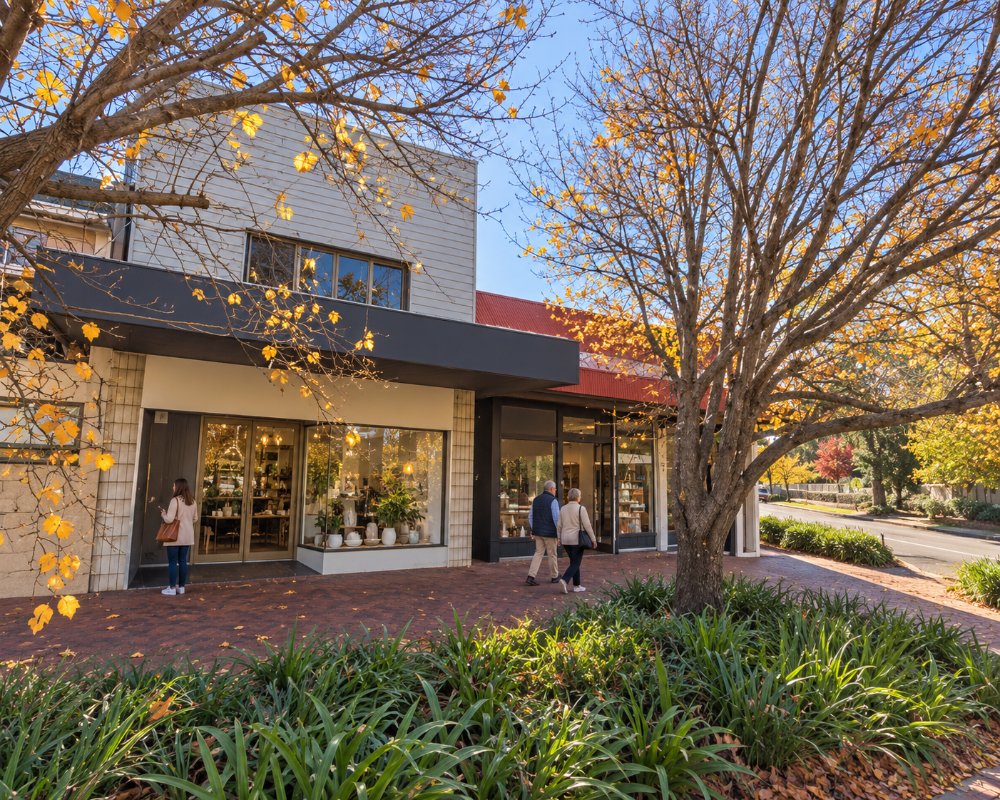
The two suburbs sit on a high ridge. Pennant Hills is the larger, at the junction of Pennant Hills Road and the road to Castle Hill. Beecroft, one stop south, is a quieter garden suburb with a strong heritage character.
Things To Do in Pennant Hills and Beecroft
Bushwalks
Pennant Hills Park, on the eastern side, is the gateway to the northern end of Lane Cove National Park. Tracks descend through tall blue gum and turpentine forest to the Lane Cove River, linking with the Great North Walk. Whale Rock, a large sandstone boulder shaped remarkably like a whale, is a favourite destination for families. Beecroft has its own network of creekside reserves with walking tracks.
Beecroft Village
Beecroft was laid out in the 1880s and has kept many of its Federation houses, churches and gardens. Its village centre has cafes, a bookshop and specialty shops around a small green.
Cumberland State Forest
A few minutes west in West Pennant Hills, this forest has easy trails, a treetop ropes course, a native plant nursery and a cafe.
Observatory Park
At Pennant Hills, a small park at the corner of Beecroft and Pennant Hills roads marks the site of the Red Hill observatory, a branch of Sydney Observatory built in the 1890s to photograph the southern sky and dismantled around 1930. A stone marker used in the first accurate survey of the colony stands nearby.
Great North Walk from Pennant Hills
The Bellamy Street trackhead in Pennant Hills is the main start of the Great North Walk through Berowra Valley National Park, heading north through Thornleigh and Hornsby to Berowra Waters, about 27 km in all.
Cumberland State Forest
On Castle Hill Road, West Pennant Hills, about 3 km west, this 40-hectare state forest dedicated in 1939 has an arboretum, short walking trails, free picnic areas, Cafe Saligna, a nursery and the Treetops Adventure ropes course. It has no public camping.
Where To Stay
Hotel Pennant Hills on Pennant Hills Road lets simple pub rooms by the week.
Larger hotels can be found in Hornsby, Castle Hill and Macquarie Park.
For short stays, the nearest choices are the Hornsby Inn, Peppers The Hills Lodge at Castle Hill and the Macquarie Park hotels. For caravans and campervans, Discovery Parks – Lane Cove at Macquarie Park is the nearest tourist park, though its powered sites were temporarily unpowered in late 2026. Pennant Hills Road is a heavy truck route, so allow time.
Eat & Drink
Both village centres have cafes, bakeries and a range of restaurants, and Pennant Hills has a traditional pub and a large bowling club.
Hotel Pennant Hills has a bistro serving lunch and dinner daily. Beecroft’s shops cluster around the Village Green on Hannah Street, with Beecroft Place for a supermarket, and Pennant Hills Marketplace on Hillcrest Road has supermarkets and cafes.
History
The ridge is the country of the Dharug and Guringai people. Its tall timber was cut for the government from the first years of the colony, with a convict sawing establishment operating here in the 1810s. Orchards followed. Beecroft was named in the 1880s by the politician Sir Henry Copeland, using the maiden name of his two wives, who were sisters. The railway opened in 1886.
Getting to Pennant Hills and Beecroft
Trains on the Northern line take about 35 minutes from Central. By car, use the M2 motorway and Pennant Hills Road, or the NorthConnex tunnel.
Experiences
- City
- Historic/Heritage
- Nature based
Popular Activities
- Bush Walking
- City Sightseeing
- National Park
- Sightseeing
About Pennant Hills and Beecroft
- Locality: Suburb
- Pennant Hills and Beecroft Postcode: 2120
- State: New South Wales
- Region: Sydney
- Latitude: -33.7387
- Longitude: 151.0714
- Elevation: 176m
- Timezone: Australia/Sydney
