
Lindfield and Roseville, NSW
Lindfield and Roseville are neighbouring suburbs on the North Shore railway, about 12 kilometres north of the centre of Sydney and just beyond Chatswood. They are leafy and residential, with small village centres, and they are flanked by two national parks whose tracks begin almost at the back fences.
Known For
- Bushwalks to Middle Harbour and the Lane Cove River
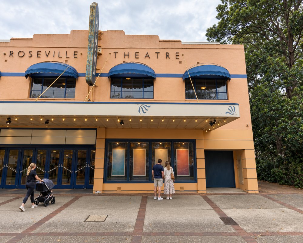
- A much-loved independent cinema
- Leafy streets of Federation houses
The Pacific Highway and the railway run along the ridge through both suburbs. East of the ridge, streets slope down to Middle Harbour Creek and the Roseville Bridge. To the west they descend to the Lane Cove River.
Things To Do in Lindfield and Roseville
Two Creeks Track
This walk of about six and a half kilometres starts near Lindfield and follows Gordon Creek and Middle Harbour Creek through Garigal National Park to the Roseville Bridge. It passes sandstone overhangs, mangroves and quiet reaches of tidal water, and feels far from the city. Allow two to three hours.
Davidson Park and Roseville Bridge
Beneath the high concrete bridge that carries the road to the northern beaches, Davidson Park has riverside picnic lawns, barbecues and a boat ramp. It is a popular place to launch kayaks for a paddle up Middle Harbour, where the banks are lined with bush.
Lane Cove River
On the western side, tracks from the end of Fiddens Wharf Road lead into Lane Cove National Park, to the site of a wharf where timber was loaded onto boats for Sydney in the early 1800s.
Roseville Cinemas
This independent picture theatre on the Pacific Highway has been showing films since the 1930s and is known for its mix of quality releases, foreign films and festivals.
Village Centres
Both suburbs have groups of shops and cafes beside their stations, and Lindfield has the Lindfield Village Green, a park with a cafe pavilion, gazebos and water features that opened on Tryon Road in 2022. The surrounding streets have many fine houses from the early 1900s.
Roseville Bridge by Kayak
Davidson Park picnic area and boat ramp, at the northern end of Roseville Bridge, is in Garigal National Park. From there paddlers can head up Middle Harbour Creek, and walks lead to the Natural Bridge and Stepping Stone Crossing.
Where To Stay
There is very little accommodation in these suburbs.
Chatswood, one or two stops south, has several large hotels and serviced apartments.
No hotel or motel in either suburb could be confirmed. Chatswood, one or two stops south, has large hotels and serviced apartments, and the Pymble Hotel, about 4 km north of Lindfield, has pub rooms. For caravans and campervans, Discovery Parks – Lane Cove at Macquarie Park is the nearest tourist park, though its powered sites were temporarily unpowered in late 2026.
Eat & Drink
Cafes, bakeries and a range of restaurants cluster near each station, with Japanese, Chinese and Italian food well represented. For a far bigger choice, go to Chatswood.
Goodfields Eatery on Lindfield Avenue opens from 6 am daily for breakfast and lunch, and the Village Green pavilion has a cafe with outdoor seating. Neither suburb has a pub; the nearest are the Greengate Hotel at Killara, with a sunny patio, and the Pymble Hotel. Chatswood has the biggest choice of food courts and restaurants.
History
The area is the country of the Cammeraygal and Guringai people. Timber-getters cleared the forest, and orchards followed. Roseville is named after Rose Villa, a cottage on one of the orchards, and Lindfield after a house called after a village in Sussex. Both developed as garden suburbs after the railway opened in 1890.
Ku-ring-gai Council names the Guringai people as the Traditional Owners. Lindfield takes its name from a cottage built in 1884 by Francis List, and Roseville’s comes from Rose Villa, a stone cottage demolished for the railway, which opened in 1890.
Getting to Lindfield and Roseville
Trains on the North Shore line reach Roseville and Lindfield in about 20 to 25 minutes from the city. Buses run along the Pacific Highway. St Leonards is a few stops south.
Experiences
- City
- Nature based
Popular Activities
- Bush Walking
- Kayaking
- National Park
- Sightseeing
About Lindfield and Roseville
- Locality: Suburb
- Lindfield and Roseville Postcode: 2070
- State: New South Wales
- Region: Sydney
- Latitude: -33.7764
- Longitude: 151.1687
- Elevation: 106m
- Timezone: Australia/Sydney
