
Numinbah Valley, QLD
Numinbah Valley is a long, narrow valley in the Gold Coast hinterland, running south from Hinze Dam to the New South Wales border between the cliffs of the Springbrook plateau and the Lamington ranges. The upper Nerang River flows down its centre past cattle farms and rainforest, and at its head is Natural Bridge, one of the most visited natural sights in Queensland.
Known For
- A scenic drive between two World Heritage plateaus
- Natural Bridge and its glow-worm cave
- River swimming holes, farm stays and bush camps
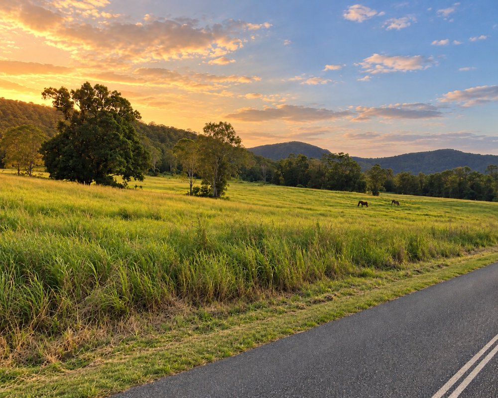
The Nerang to Murwillumbah road runs the length of the valley, about 25 kilometres from the dam to the border gate. Along it are a community hall, a school, an environmental education centre and scattered farms, with volcanic crags rising above the pasture on both sides. There is no village as such.
The valley is usually driven as part of a hinterland loop, but it rewards a slower visit, especially for those who stay overnight and see the glow-worms after dark.
Things To Do in Numinbah Valley
The Valley Drive
From Nerang the road passes Hinze Dam and follows the lake shore before entering the valley proper. The scenery builds as you go: river flats and grazing cattle in the foreground, forested slopes behind, and above them the rhyolite cliffs of Springbrook to the east and the Ships Stern range to the west. Distinctive outcrops such as Egg Rock and Turtle Rock stand above the paddocks. The road is sealed and winding, popular with motorcyclists, and should be driven with care.
Natural Bridge
Near the top of the valley, the Natural Bridge section of Springbrook National Park protects a remarkable rock arch. A sealed one-kilometre circuit descends through ancient rainforest to a cavern where Cave Creek plunges through a hole in the roof into a pool. After dark the ceiling glitters with the blue-green lights of thousands of glow-worms, most numerous in the warmer, wetter months from December to March. Swimming is not allowed, torches should be kept pointed at the ground, and flash photography harms the colony. Guided night tours run from the coast for those who would rather not drive back in the dark.
Swimming Holes and Picnics
The Nerang River is clear and cool in its upper reaches. Bochow Park, beside the road in the upper valley, has picnic tables, barbecues, toilets and a shallow swimming hole that suits families, and there are other informal access points along the way. Water levels rise fast after rain.
Horse Riding and Farm Experiences
Trail rides through farmland, creek crossings and forest are offered in the valley, with options for beginners and experienced riders. Some properties welcome visitors for farm stays, and roadside stalls sell local produce.
Up to Springbrook
Pine Creek Road climbs steeply from the valley to the Springbrook plateau, linking Natural Bridge with Purling Brook Falls, Canyon Lookout and the Best of All Lookout. Combined with Springbrook Road down to Mudgeeraba, it makes a full-day loop from the coast.
Across the Border
The road crosses into New South Wales at a gap in the range a few kilometres beyond Natural Bridge, then descends through the Tweed Valley to Chillingham and Murwillumbah. A cattle grid and a tick gate mark the state line.
Numinbah Valley School of Arts
The timber hall on the right as you enter the hamlet, at 2136 Nerang-Murwillumbah Road, is the heritage-listed Numinbah Valley School of Arts. Locals raised the money and donated the timber, which the Yaun family’s sawmill nearby cut free of charge, and the hall opened in 1926. The valley’s first school began inside it the next year, and it has hosted dances, weddings and church services ever since; the bar in the supper room carries murals painted in 1983 by a prisoner from the nearby state farm.
Gold Coast Hinterland Great Walk
The Gold Coast Hinterland Great Walk crosses the valley on its 54 km route between the Green Mountains section of Lamington National Park and the Springbrook plateau. Most walkers take three days and stay at walkers’ camps booked through Queensland Parks and Wildlife, but the valley sections also make good day walks.
Where To Stay
Accommodation is small-scale, rural and spread out.
Cabins, cottages and farm stays are dotted along the valley, many beside the river or on hillsides with views of the cliffs. They range from simple bunkhouses to comfortable self-contained retreats with fireplaces, and most need a booking in advance.
Private camp grounds along the river take tents, camper trailers and caravans, with swimming holes and campfires among the attractions. They are popular on long weekends and in school holidays.
There are no hotels. The nearest are on the coast or at Nerang, 30 to 40 minutes away, and Springbrook has further cabins and a national park camp ground.
For caravans and camping, Numinbah Valley Bush Camping, at 2524 Nerang-Murwillumbah Road about 7 km short of Natural Bridge, takes everything from swags to caravans on mown sites spread along the creek, with hot showers, flushing toilets, a dump point and campfires when conditions allow; dogs are welcome by arrangement. The track down to the lower riverside sites can be steep and slippery after rain, so ask which sites suit your rig before you book.
At the northern end of the valley, Advancetown Caravan Park, at 376 Nerang-Murwillumbah Road about 4 km from Nerang, is a small, quiet, pet-friendly park in bushland with powered sites, a few minutes from Hinze Dam and about 30 km from Natural Bridge.
The valley road itself is sealed and suits caravans driven with care, but Pine Creek Road up to Springbrook is steep and narrow and not for vans, and the final climb over the border towards Chillingham is steep and winding. The national park camping area on Springbrook, the Settlement, takes tents, camper trailers and campervans only, with no caravans.
Eat & Drink
There is very little in the valley. One or two country cafes near Natural Bridge and along the road serve coffee, pies, burgers and Devonshire teas, generally during the day and not always midweek.
Bring food and water, especially if staying for the glow-worms. Picnic areas at Bochow Park and at the Natural Bridge car park have tables, and the cafe and pub at Advancetown, at the northern end of the valley, are the nearest places for a sit-down meal. There is no fuel in the valley.
The nearest reliable cafe is at the Hinze Dam visitor centre on Advancetown Road, at the northern end of the valley, with views across the lake to the mountains; it suits a breakfast stop on the way in.
For a full meal on a loop drive that climbs Pine Creek Road and returns down Springbrook Road, finish in Mudgeeraba, where the Wallaby Hotel on Railway Street has a bistro and a big open-air deck, and Mudjira Village Eatery on Swan Lane does breakfast and lunch.
There is no shop in the valley. Nerang, about 35 km north of Natural Bridge, has supermarkets and service stations, so stock up and fill the tank there before heading south, and carry food, water and a torch if you are staying for the glow-worms.
History
Numinbah Valley is in the country of the Yugambeh-speaking peoples, and the valley was a well-used pathway between the coast, the ranges and the Tweed. Cedar-getters entered in the 1870s and hauled logs out by bullock team.
Dairy farmers followed from the early 1900s, and a school and hall were built to serve them. The road through the gap to the Tweed was completed in the 1920s. Natural Bridge was protected as a national park in 1959 and now forms part of the Gondwana Rainforests World Heritage Area.
Getting to Numinbah Valley
Leave the Pacific Motorway at Nerang and follow the Nerang to Murwillumbah road south. Natural Bridge is about 35 kilometres from Nerang, a drive of 45 minutes, and about an hour from Surfers Paradise. From Brisbane allow close to two hours.
There is no public transport. Parking at Natural Bridge is limited and fills on weekends and at dusk in summer.
Experiences
- Eco Tourism
- Mountain
- Nature based
- Relaxation
Popular Activities
- Bush Walking
- Caravan and Camping
- National Park
- Rainforest
- Sightseeing
- Swimming
About Numinbah Valley
- Locality: Rural locality
- Numinbah Valley Postcode: 4211
- State: Queensland
- Region: Gold Coast
- Latitude: -28.14523
- Longitude: 153.23461
- Elevation: 148m
- Timezone: Australia/Brisbane
