
Currumbin Valley, QLD
Currumbin Valley runs inland from the southern Gold Coast for about 20 kilometres, following Currumbin Creek from the suburbs behind Currumbin to the rainforest of the border ranges. It is a narrow, green valley of small farms, creek crossings and steep forested ridges, with freshwater swimming holes and a national park at its head, all within half an hour of the beach.
Known For
- Freshwater swimming at the Currumbin Rock Pools
- Cougal Cascades in Springbrook National Park
- Farm-gate stalls and a scenic valley drive
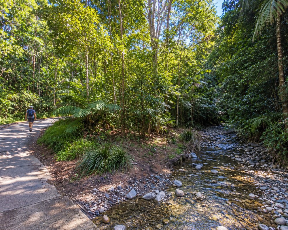
A single road, Currumbin Creek Road, runs the length of the valley and ends at the national park car park. A side road, Tomewin Mountain Road, climbs out of the valley to the New South Wales border. There is no town, only scattered houses, a community hall, a school and a handful of cafes and stalls.
The valley is a favourite Sunday drive for locals and one of the most popular cycling routes on the coast. Visit on a weekday for the quietest experience.
Things To Do in Currumbin Valley
Currumbin Rock Pools
About halfway up the valley, the creek spreads over smooth rock shelves into a series of clear pools, the deepest of which is used for swimming and for jumping from the rocks. A grassy picnic area with barbecues and toilets sits beside the road, and there is a cafe opposite. The pools are busy on hot weekends. The water can be cold, the rocks are slippery, and conditions change quickly after heavy rain, so check the depth before entering and never dive.
Cougal Cascades
At the end of the road, the Mount Cougal section of Springbrook National Park protects the headwaters of the creek beneath the twin peaks of Mount Cougal. A sealed track of about 800 metres follows the creek through subtropical rainforest to lookouts over Cougal Cascades, where water slides down a chute of polished rock into deep pools. A little further on are the restored remains of a bush sawmill that cut timber here in the 1940s and 1950s. The walk is easy and shaded. Swimming is allowed in parts of the creek, but sliding down the cascades is dangerous and prohibited.
The Valley Drive
The drive itself is a pleasure, crossing the creek on low bridges and passing banana plantations, horse paddocks and rainforest remnants. Honesty boxes and farm stalls along the way sell bananas, avocados, citrus, honey, eggs and flowers, depending on the season. Carry coins or small notes.
Tomewin Mountain Road
This steep, winding side road climbs to the state border on the rim of the Tweed Valley, with broad views towards Mount Warning and the coast. An organic farm near the top opens to visitors on some days with a cafe and produce stall. The road continues down to Murwillumbah in New South Wales.
Cycling and Wildlife
Road cyclists ride the valley in numbers early on weekend mornings, so drivers should take care on the bends. Platypus live in the quieter stretches of the creek, and the rainforest at the head of the valley shelters pademelons, lyrebirds and many other birds.
Ground Currumbin and the Ecovillage
Near the bottom of the valley, the Ecovillage at Currumbin is a sustainable housing estate of about 150 homes on 110 hectares, which has won more than 30 awards since its first house was finished in 2006. Its entry road, Village Way, is public, and at No. 2 the Ground Currumbin hub welcomes visitors with the Pasture & Co cafe, the Ground Grocer organic produce store, a bathhouse with a wood-fired sauna and hot tub, and a glasshouse used for events. The estate is also home to dozens of kangaroos.
Where To Stay
Staying in the valley means a rural retreat, not a resort.
A small number of farm stays, cabins, cottages and bed and breakfasts are spread along the valley and on the ridges above it. Many are set on working farms or bush blocks, with creek frontage, fire pits and views, and they suit couples and families looking for quiet.
An ecovillage in the lower valley, known for its sustainable design, has some guest accommodation and a village cafe. There is no camping in the Mount Cougal section of the national park.
The beachfront apartments of Currumbin, Palm Beach and Tugun are 15 to 25 minutes from the rock pools, so the valley is easily visited on a day trip.
For a full escape, Eden Retreat, at 1815 Currumbin Creek Road in the upper valley, is a wellness retreat where stays include meals and spa treatments, with a heated pool, sauna and hot tub; it suits adults on a health break rather than families. Most of the valley’s cottages and cabins are let through holiday-rental sites, and several stand within a couple of kilometres of the rock pools, with creek frontage and room for bikes.
There is no caravan park or camping ground anywhere in the valley. Currumbin Creek Road is fine for cars and small campervans as far as the rock pools and the national park car park, but it narrows and twists in its upper half and parking is tight, so it does not suit big vans. Tomewin Mountain Road, which climbs from the valley to the border, is steep and tight and best avoided with a caravan.
The nearest van sites are at the council’s Tallebudgera Creek Tourist Park at Palm Beach, about 15 km from the rock pools, and Kirra Beach Tourist Park, about 18 km away, both with powered sites and cabins. The nearest national park camping is at the Settlement on Springbrook, reached by way of Mudgeeraba, and it takes tents, camper trailers and campervans but not caravans.
Eat & Drink
Options are few and informal, which is part of the charm. The cafe at the rock pools serves coffee, burgers, cakes and ice creams to swimmers and cyclists, and one or two other cafes and farm kitchens along the road open mainly from Thursday or Friday to Sunday.
A picnic is the best plan. Buy fruit and honey from the roadside stalls, bring the rest from the coast, and use the tables at the rock pools or at the national park.
For dinner, return to the coast. The breweries and cafes of the Currumbin industrial estate are at the mouth of the valley, and the restaurants of Palm Beach are a few minutes further.
Currumbin Valley Rock Pool Cafe, at 1206 Currumbin Creek Road directly across the road from the pools, is the one reliable stop in the middle of the valley, serving coffee, breakfast and light lunches to swimmers and cyclists during the day; check its opening days before you go.
Lower down, at the entrance to the Ecovillage at 2 Village Way, Pasture & Co at Ground Currumbin does coffee and brunch next to an organic grocer that sells local produce, handy for a picnic.
At the mouth of the valley in Currumbin Waters, Fuel Bakehouse at 44 Currumbin Creek Road is the place to pick up pies and pastries before the drive, and Dust Temple at No. 54 is a warehouse cafe, gallery and bar with evening music. Balter Brewing’s taproom is a minute away on Traders Way. For a waterfront meal, Tarte Beach House and the Currumbin RSL, both on the creek at Currumbin, are about 15 km from the rock pools.
There are no shops or fuel in the valley, so fill up and buy supplies on the coast; the nearest big supermarkets are at Elanora.
History
Currumbin Valley is in the country of the Yugambeh-speaking peoples, who travelled the creek between the coast and the ranges. Timber-getters came in the second half of the 1800s for cedar, beech and hoop pine, hauling logs to the creek mouth.
Farmers followed, growing bananas on the steep slopes and running dairy herds on the flats, and the valley supplied fruit to Brisbane by rail from Currumbin. The forest at the head of the valley was logged until the mid-twentieth century and later added to Springbrook National Park, which is part of the Gondwana Rainforests World Heritage Area.
Getting to Currumbin Valley
From the Pacific Motorway, take the Stewart Road exit at Currumbin and follow Currumbin Creek Road west. The rock pools are about 12 kilometres from the motorway and the national park about 20, a drive of 25 to 30 minutes. From Brisbane the valley is about 100 kilometres.
There is no public transport. The road is sealed but narrow and winding in its upper half, and parking at both the rock pools and the national park is limited on fine weekends.
Experiences
- Eco Tourism
- Mountain
- Nature based
- Relaxation
Popular Activities
- Bush Walking
- Cycling
- National Park
- Rainforest
- Swimming
About Currumbin Valley
- Locality: Suburb
- Currumbin Valley Postcode: 4223
- State: Queensland
- Region: Gold Coast
- Latitude: -28.18819
- Longitude: 153.42045
- Elevation: 71m
- Timezone: Australia/Brisbane
