
Lavers Hill, VIC
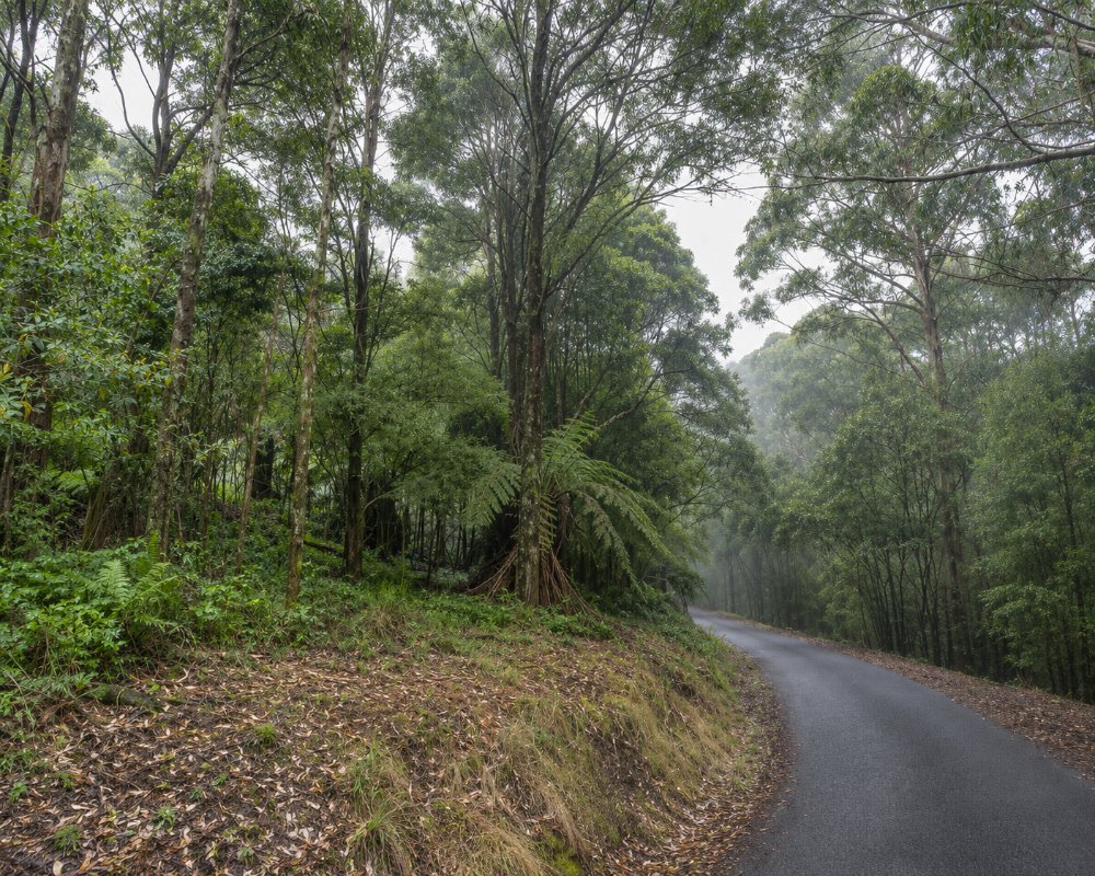
Lavers Hill is a tiny settlement on a ridge of the Otway Ranges at the highest point of the Great Ocean Road, about 47 km west of Apollo Bay and 230 km from Melbourne by the coast. It is little more than a roadhouse, a restaurant and a few houses in the misty forest, but it is a welcome stop on the long inland stretch of the road between Apollo Bay and Princetown.
Around it are some of the Otways’ best natural sights: the rainforest and glow worms of Melba Gully, the wild surf of Johanna Beach and, a short drive inland, the Otway Fly and the waterfalls around Beech Forest.
Known For
- The highest point on the Great Ocean Road
- Melba Gully rainforest and glow worms
- Wild Johanna Beach and the Great Ocean Walk
Things To Do in Lavers Hill
Melba Gully
Three kilometres west, Melba Gully is a pocket of cool temperate rainforest with myrtle beech, tree ferns and a short loop walk, Madsens Track, of about 1.5 km. After dark, glow worms light up the banks along the track all year round. There is no camping and dogs are not allowed.
Johanna Beach
A winding road leads down from the ridge to Johanna Beach, a long, wild surf beach backed by dunes and green hills. It is beautiful for walking, but swimming is dangerous. Hooded plovers nest on the sand in spring and summer. The Great Ocean Walk passes along the beach.
Moonlight Head and Wreck Beach
Further west, tracks lead down to Moonlight Head and Wreck Beach, where the anchors of two shipwrecks lie in the rock platform at low tide. The steps down are steep.
Otway Fly and the Waterfalls
Inland, the Otway Fly treetop walk, Triplet Falls and Hopetoun Falls are 20 to 30 minutes away near Beech Forest.
Glenaire and the Aire River
East of Lavers Hill, the Great Ocean Road drops to Glenaire and the Aire River, where the river winds through wetlands to the sea. Castle Cove lookout, beside the road just west of Glenaire, looks down on a wild cove and the cliffs towards Johanna. Down on the river, Aire River West and East campgrounds are popular for canoeing, fishing and birdwatching, and the Great Ocean Walk crosses the river on its way to Cape Otway.
Where To Stay
The Lavers Hill Roadhouse and Tavern has had cabins and powered sites, but the property has changed hands recently, so phone ahead. There are cottages and B&Bs in the surrounding forest.
Johanna Beach Campground, below the ridge, has 25 bookable unpowered sites with non-flush toilets and no showers, and dogs are allowed on a lead. For full facilities, Otways Tourist Park at Gellibrand, 30 km north, has powered sites and a dump point. Fuel is limited between Apollo Bay and Port Campbell, so top up where you can. The roads around Lavers Hill are winding and often wet, so take care towing.
Johanna Beach Campground is reached by a gravel road off the Great Ocean Road near Glenaire, and its sites suit caravans as well as tents. Since July 2026 it is managed and booked by the Great Ocean Road Coast and Parks Authority, along with the Aire River and Blanket Bay campgrounds, and peak summer stays carry minimum-night rules. Above the beach, Johanna River Farm has self-contained cottages, and The Roost at Johanna also takes guests.
To the east, Bimbi Park at Cape Otway, about 35 km away off Lighthouse Road, has powered, unpowered and bush sites, cabins and camping pods among the koalas. To the west, the Princetown Recreation Reserve, about 35 km away, takes campers and caravans. Otways Tourist Park at Gellibrand adds a heated pool and pet-friendly sites to its cabins and caravan sites.
The Colac-Lavers Hill Road north through Beech Forest is sealed and the easiest inland route for vans, and the Otway Fly car park takes caravans and motorhomes. The roads down to Johanna and Moonlight Head are steep and narrow, so leave big rigs at the top if you are not camping.
Eat & Drink
The Perch Restaurant, Winery and Gardens is the standout, cooking modern Australian food with produce from local Otway farms and its own kitchen garden, with lunch and dinner daily. The Lavers Hill Roadhouse and Tavern serves pub meals and sells fuel. Towards Princetown, Clean Cravings Eatery at the Great Ocean Road Wildlife Park offers salads and toasties.
The Perch at Lavers Hill, at 1-15 Great Ocean Road on the highest point of the coast road, is the place to stop. The kitchen works with Otway farmers, fishers and its own kitchen garden of native berries, herbs and vegetables, the bar runs to local wines and cocktails, and between courses you can walk the gardens and old-growth forest trail, where koalas and glow worms are often seen. It also hosts live music and trivia nights; book for dinner.
About 15 minutes inland, The Beechy Hotel at Beech Forest serves pub meals, burgers and woodfired pizza by a wood heater, and the Otway Fly cafe has takeaway meals with vegan and gluten-free choices. Towards Princetown, Clean Cravings Eatery at Gellibrand Lower makes plant-based sandwiches, salads and soups, and the Princetown General Store, Cafe and Bar, about 35 km west, sells coffee, craft beer and everyday supplies above the Gellibrand River estuary. To the east, the Lightkeeper’s Cafe at the Cape Otway Lightstation and the Emu Cafe at Wildlife Wonders in Apollo Bay are good lunch stops. Apollo Bay and Colac have the nearest supermarkets, and Apollo Bay and Port Campbell have fuel.
History
This is the Country of the Gadubanud people of the Eastern Maar. Selectors cleared the forest from the 1880s and 1890s. The narrow-gauge railway from Colac was extended through Lavers Hill to Crowes in 1911; the section beyond Ferguson, through Lavers Hill, closed in 1954, and the rest of the line in 1962.
Getting to Lavers Hill
Lavers Hill is about 230 km from Melbourne via the Great Ocean Road, or about 200 km inland via Colac and Gellibrand on the Colac Lavers Hill Road. Apollo Bay is 47 km east and Princetown about 35 km west. V/Line coaches between Apollo Bay and Warrnambool pass through on certain days.
Experiences
- Eco Tourism
- Nature based
- Rural/Country
- Self-Drive
Popular Activities
- Beach
- Bush Walking
- Caravan and Camping
- National Park
- Rainforest
- Sightseeing
- Surfing
About Lavers Hill
- Locality: Rural locality
- Lavers Hill Postcode: 3238
- State: Victoria
- Region: Great Ocean Road
- Latitude: -38.67908
- Longitude: 143.39245
- Elevation: 458m
- Timezone: Australia/Melbourne
