
Coleraine, VIC
Coleraine lies in the rolling red gum country of the Western District, about 330 km west of Melbourne and 34 km west of Hamilton on the Glenelg Highway. It is a handsome old pastoral town in a valley on Bryans Creek, with stone churches, a historic railway station and one of the finest eucalypt collections in the world on the hill above town.
It makes a peaceful stop between Hamilton and Casterton or the South Australian border, and a base for the waterfalls and reservoirs of the southern Grampians country.
Known For
- The Peter Francis Points Arboretum and its eucalypts
- Wannon and Nigretta falls nearby
- Red gum country and historic churches
Things To Do in Coleraine
Peter Francis Points Arboretum
On a hill overlooking the town, the arboretum is a 37 ha former quarry planted with more than 10,000 plants of about 2,200 species, including more than 500 kinds of eucalypt, one of the largest collections in the world. Walking tracks and lookouts wind through it, and it is at its most colourful when the gums flower in spring and summer. Find it on Points Road off Top Hilgay Road.
Railway Station and Museum
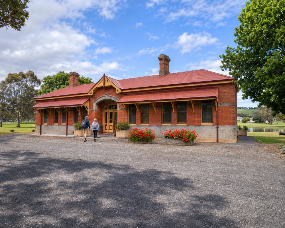
The 1882 railway station on Pilleau Street houses the Coleraine Tourist and Exhibition Centre, and the Local History Centre and Museum, in the old court house on Whyte Street, opens by appointment.
Historic Churches
Holy Trinity of 1865, St Joseph’s of 1888 and St Andrew’s of 1892 stand on Church and Read streets, a fine group of country churches. A cairn on the Glenelg Highway at the eastern edge of town commemorates the poet Adam Lindsay Gordon, who worked in the district.
Wannon and Nigretta Falls
About 16 km south-east, Wannon Falls drops about 30 m over a basalt ledge into a wide pool, with a viewing platform and picnic area. Nigretta Falls, about 25 km south-east, is a broader cascade with a lookout and steps down to the river.
Konongwootong Reservoir
About 10 km north, Konongwootong Reservoir, built in 1926, is a quiet spot for fishing and picnics.
Where To Stay
The Coleraine Hotel on Whyte Street has rooms, and there are farm stays and B&Bs in the district.
Coleraine Caravan Park, run by the council on Cox Street, has powered and unpowered sites and is an easy walk to the main street. It is a good overnight stop on the Glenelg Highway, which is sealed and suits caravans. Hamilton, 30 minutes east, has more parks, dump points and supermarkets, and the road west to Casterton and the South Australian border is easy towing.
The Coleraine Hotel has seven traditional pub rooms upstairs with shared bathrooms, and the National Hotel, a large two-storey brick pub further along Whyte Street, also offers rooms. The council caravan park is booked online and has a toilet and shower block and a coin laundry. Self-contained travellers can also stay at the Coleraine Railway Reserve, a large grassed area beside the old railway station and visitor centre, with a view over the valley. About 15 km east, Wannon Falls Reserve has bush camping near the falls, with drop toilets, fire pits and firewood, and it suits tents, caravans and motorhomes.
Konongwootong Reservoir, north of town, is for day visits only, as camping, petrol-engined boats and waterskiing are not allowed. The Coleraine Cup in September and the Coleraine Show in November are the busiest weekends, so book ahead then. Casterton, about 35 km west, and Hamilton, 34 km east, have more motels, cabins and caravan parks, and Hamilton has the nearest dump points.
Eat & Drink
The Catching Pen Cafe on Whyte Street is also a bakery and the best spot for coffee, pies and lunch. The Coleraine Hotel next door serves bistro meals. For a wider choice of cafes and restaurants, Hamilton is half an hour east.
The Catching Pen is a home-style cafe run by locals, with focaccias, soups, cakes and freshly baked bread, a few local products and gifts, and a room next door that hosts pop-up workshops; it has ramp access and is easy with children. The Coleraine Hotel was established in 1858 and rebuilt in 1930, and its dining room with leadlight windows is the place for a pot and parma, wood-fired pizza or a bistro lunch. The National Hotel at 70 Whyte Street, a town landmark since 1934, is home to the National Smokehouse, which serves smoked meats and eggs, pizzas and desserts and runs themed meal nights.
Glenelg Fine Chocolates on Whyte Street makes German-style continental chocolates by hand, including truffles, peppermint sticks, hazelnut crisps, marzipan and cherry liqueurs. For a picnic, the lookouts at the Peter Francis Points Arboretum and Queens Park, a 90-acre reserve on the north side of Bryans Creek, are good spots. Coleraine has a supermarket and fuel on Whyte Street, the Glenelg Highway through town.
History
This is Gunditjmara and Jardwadjali Country. The district saw some of the worst violence of the frontier: the Fighting Waterholes massacre took place at Konongwootong in the early 1840s, and the Fighting Hills massacre near Casterton. The settlement grew at Bryans Creek Crossing and was renamed Coleraine in 1853. The railway station building of 1882 survives.
Getting to Coleraine
Coleraine is about 330 km from Melbourne via Ballarat, Dunkeld and Hamilton on the Glenelg Highway, around four hours. Casterton is about 35 km west. V/Line coaches between Mount Gambier and Ballarat stop in Coleraine.
Experiences
- Historic/Heritage
- Nature based
- Rural/Country
- Self-Drive
Popular Activities
- Bird Watching
- Bush Walking
- Caravan and Camping
- Fishing
- Shopping
- Sightseeing
