
Coledale, NSW
Coledale is a small beach village on the coast road north of Wollongong, about 68 km south of Sydney. Like its neighbours it began as a coal-mining settlement on the thin strip of land between the Illawarra escarpment and the sea. It is known for its relaxed atmosphere, a campground right on the beach and a monthly market.
Known For
- Camping on the beachfront
- Coledale and Sharkys beaches
- A monthly village market
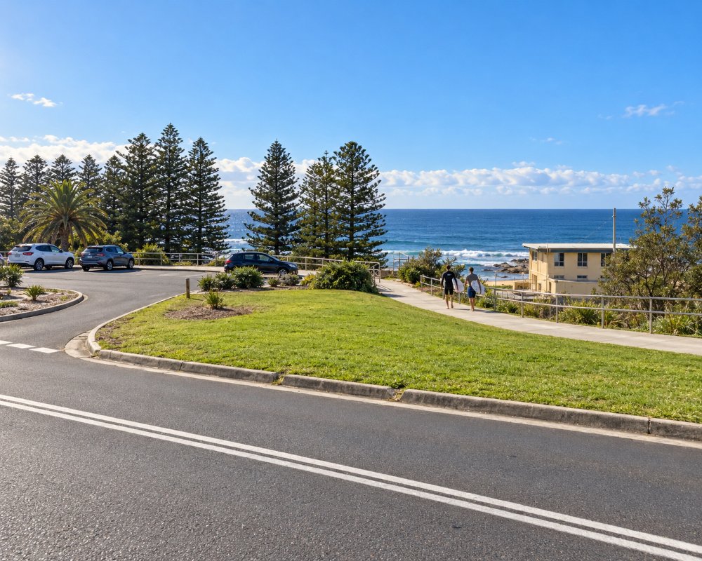
The village has a short main street with a few cafes, an RSL club, a little hospital and a railway station. Timber cottages climb the slope towards the cliffs, which rise about 300 metres behind.
Things To Do
Coledale Beach
The main beach is patrolled in summer and has an ocean pool at its southern end. A grassy reserve behind the sand has barbecues and a playground.
Sharkys Beach
Just south, this unpatrolled beach is a well-known surf break. Dogs are allowed off the leash.
Coledale Markets
On the fourth Sunday of most months, stalls selling crafts, clothing, plants and food fill the grounds of the public school, with live music.
Comradeship Sculpture
A sculpture near the beach, known as Comradeship, commemorates the mining community that founded the village.
Escarpment Walks
Steep tracks climb from the villages along this coast to the top of the escarpment, linking with the Forest Walk to Sublime Point.
History
Coledale is in the country of the Wodi Wodi people of the Dharawal nation.
The North Illawarra Coal Company opened a mine here in 1889, and it was reworked as the North Bulli Colliery from 1902, and the village that grew beside it was named Coledale. The mine closed in 1926 and reopened from 1942 to 1972, and other collieries nearby kept the community going. A hospital built for miners in 1917 still operates.
In 1886-87 the North Illawarra company built a 260-metre jetty at the southern end of Coledale Beach, and the first ship to load there, the Waratah, was blown onto the beach and lost in June 1887. The jetty was later abandoned and burnt in 1915.
Where To Stay
The beachfront camping reserve, run by the surf club, has powered and unpowered sites and is very popular in summer. There are also holiday houses.
The reserve has powered, unpowered and beachfront sites, hot showers, a kitchen and a coin laundry, but no pets or campfires. Bookings are by phone, payment is taken in full, and summer and holiday weekends book out months ahead.
Thirroul and Wollongong offer hotels and motels.
Wollongong City Council’s tourist parks at Bulli Beach, Corrimal and Windang have van and tent sites and cabins. With a big van, take the M1 over Mount Ousley and Memorial Drive north to Bulli rather than the steep descents from Bald Hill or Bulli Pass.
Eat & Drink
There are cafes, a fish and chip shop and an RSL club in the village, with more choice in Thirroul.
Saltie Dog Coffee and Crepes, on Lawrence Hargrave Drive, is the village’s best-known cafe, and Coledale RSL is a community club with a back deck looking to the mountain and the sea; its bistro serves fish and chips, schnitzels and seafood from Thursday to Sunday, with regular live music. For groceries and fuel, Thirroul, about 5 km south, has Coles and IGA.
Earth Walker & Co, in the old co-op and newsagency, is a cafe and general store with a pantry, ready meals and fire-cooked feasts to take home. Saltie Dog, in the former Sketches Cafe, makes East European-style crepes, sweet and savoury, and a honey cake. Rosie’s Fish and Chips beer-batters wild-caught Australian fish to order, with triple-cooked chips (closed Monday and Tuesday), and the same team now cooks pub classics in the RSL’s bistro, a club the community saved from closure.
Getting There
Coledale is on Lawrence Hargrave Drive, reached from Sydney via Bulli Pass or the coast road through Stanwell Park. Trains on the South Coast line stop at the station.
Experiences
- Caravan and Camping
- Nature based
- Relaxation
Popular Activities
- Beach
- Bush Walking
- Caravan and Camping
- Surfing
- Swimming
About Coledale
- Locality: Suburb
- Coledale Postcode: 2515
- State: New South Wales
- Region: South Coast
- Latitude: -34.28828
- Longitude: 150.94740
- Elevation: 11m
- Timezone: Australia/Sydney
