
Warooka, SA
Warooka is a small farming town on the foot of Yorke Peninsula, about 230 km by road from Adelaide. It is the last town of any size before the far south-west of the peninsula, and most visitors pass through on their way to the beaches of Point Turton and Corny Point or to Dhilba Guuranda-Innes National Park.
Known For
- Gateway to the foot of Yorke Peninsula
- Point Turton and Flaherty Beach
- Corny Point lighthouse and surf coast
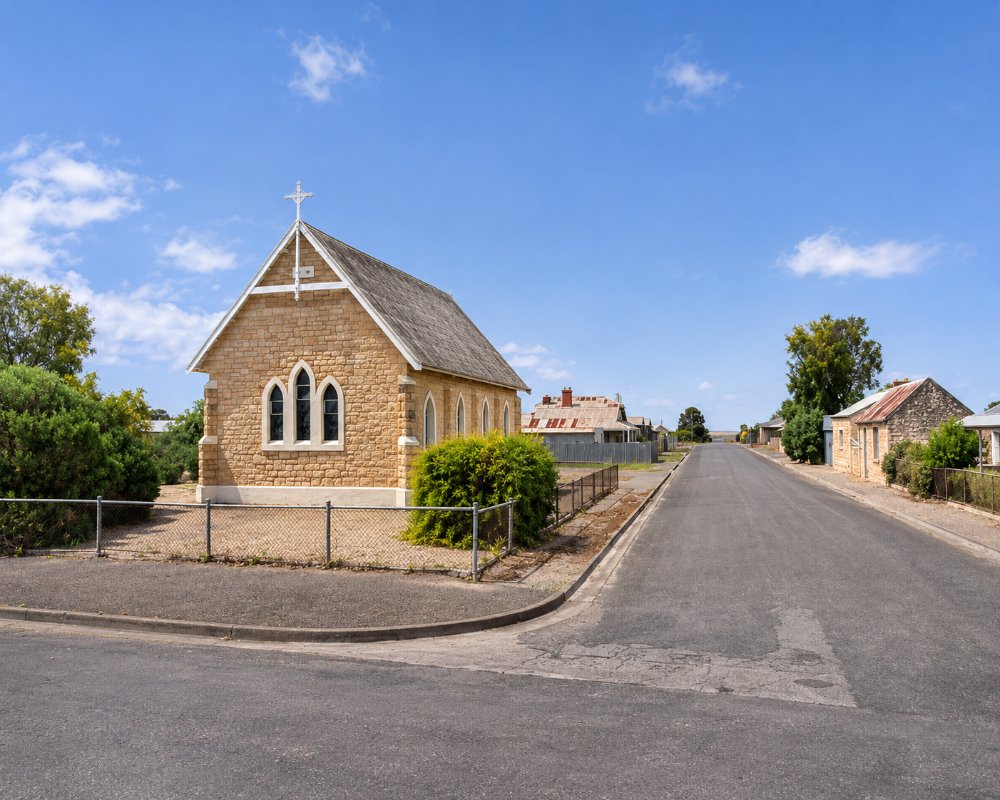
The town stands on a low rise among barley and wheat paddocks, 10 km from the coast at Point Turton. It has a pub, a store, fuel and a handful of stone buildings from the 1870s and 1880s.
Things To Do
Point Turton
Ten minutes away on Hardwicke Bay, Point Turton has a jetty, a boat ramp, a caravan park in an old limestone quarry and excellent fishing for King George whiting. Just along the shore, Flaherty Beach is a wide expanse of white sand and shallow turquoise water, at its best at low tide.
Corny Point
At the north-western tip of the foot, a stone lighthouse built in 1882 overlooks Spencer Gulf. The coast to the south, through Berry Bay and Daly Head, has some of the best surf beaches in the state and dramatic cliffs.
Dhilba Guuranda-Innes National Park
The national park, with its surf beaches, shipwrecks and the ghost town of Inneston, is about 45 minutes south via Marion Bay.
Local History
A small museum in the old police station and the surrounding heritage buildings give a glimpse of the early farming years.
Warooka Mural Trail
Eight large murals around the town and district show coastal and underwater scenes, farm landscapes, wildlife and local history. They came out of a series of community art projects led by a local muralist, and several were painted with local children and visiting artists. Allow an hour or so to find them all on foot and by car.
Sandbar Golf at Flaherty’s Beach
Each January or February, on the Sunday nearest the dodge tide, two six-hole golf courses are marked out on the sand flats at Flaherty’s Beach, a few kilometres north of town, as the tide drops. The Warooka Progress Association started the event in 1997, and it is a family day where every hole is a bunker and the water hazards are real.
Warooka Museum and the 150th
The museum in the old police station holds a wide-ranging collection of items gathered from the surrounding district and opens on Fridays or by appointment. Warooka was established in 1876 and marks its 150th anniversary in 2026, a good year to catch a local event.
History
Warooka is on Narungga country. The name comes from the Narungga word Wiruka, usually translated as muddy waterhole.
Sheep runs were established on southern Yorke Peninsula in the 1840s and 1850s. The town was surveyed in 1876 as the district was opened for cropping, and by the 1880s it had a hotel, churches and a school. In 1902 Warooka was close to the centre of one of the strongest earthquakes recorded in South Australia, which damaged most of the stone buildings in the district.
Where To Stay
Warooka has a hotel with rooms.
Warooka has no caravan park, but the Warooka Camping Grounds beside the oval offer low-cost camping with toilets and water, and a dump point that campers can use. The nearest caravan park is at Point Turton, ten kilometres west, and council bush campgrounds along the coast beyond need a permit bought online.
There are caravan parks and holiday houses at Point Turton and Corny Point, and more at Marion Bay.
The Warooka Camping Grounds beside the oval are a cheap overnight stop with toilets and water. The dump point is included in the nightly camping fee, and other travellers can use it for a small charge, which makes the town a handy place to empty tanks before the bush camps further south and west.
The council’s Sturt Bay bush campground is about 13 km south, the last 11 km on unsealed Sturt Bay Road. Its sites are unallocated, first come first served, and suit tents and smaller vans, but the turning area is tight for large caravans. The beach over the dunes is good for swimming, snorkelling, kayaking and fishing. Gleesons Landing, about 40 km west via the unsealed White Hut and Gleesons roads, has winding tracks to sites near the water; walk them first if you are towing a big rig. Council bush camping permits cost about $20 a night per vehicle and must be bought online before you set up.
For a roof, Ballara Art and Lifestyle Retreat is a restored 1910 family home in town, built for one of Warooka’s early storekeeping families. Point Turton Caravan Park, 10 km west, sits in an old quarry beside the jetty and boat ramp, and Corny Point Caravan Park has cabins and a century-old stone cottage.
Eat & Drink
The hotel serves meals, and there is a general store and roadhouse. The tavern at Point Turton and the store at Corny Point are the other options nearby.
The Warooka Hotel, trading since 1877 and the last pub before the bottom end of the peninsula, has a cosy front bar and a seasonal menu of country pub meals, salads and burgers, with a list of South Australian wines. Lower Yorke Seafood and Salt Food and Events, on the Yorke Highway, sells locally caught seafood to eat in, take away or cook at your camp.
Ten minutes west, the Point Turton Tavern sits above the jetty with wide views over Hardwicke Bay and Flaherty’s Beach. It specialises in South Australian seafood, has a children’s playroom and a licensed veranda and lawn, and it is best to book for meals. The Point Turton general store opens seven days for takeaway, bait, gas refills and fuel. At Corny Point, about 40 km west, The Corny Shop has takeaway, ice creams, groceries, bait and ice.
For a bigger shop, Yorketown Foodland is 24 km east and Minlaton Foodland about 35 km north. Warooka’s fuel station keeps short weekend hours and is closed on Sundays, so fill up during the week or at Point Turton.
Getting There
From Adelaide, follow the Yorke Highway down the peninsula through Minlaton, about two and three quarter hours. Warooka is 22 km west of Yorketown and 50 km from Marion Bay.
Experiences
- Caravan and Camping
- Relaxation
- Rural/Country
- Self-Drive
Popular Activities
- Beach
- Caravan and Camping
- Driving
- Fishing
- Surfing
About Warooka
- Locality: Urban locality
- Warooka Postcode: 5577
- State: South Australia
- Region: Yorke Peninsula
- Latitude: -34.99006
- Longitude: 137.39882
- Elevation: 56m
- Timezone: Australia/Adelaide
Accommodation In Warooka
Discover some of the accommodation in and around Warooka
