
Brooweena, QLD
Brooweena is a tiny rural township 49 km west of Maryborough, on the road to Biggenden in Queensland’s Fraser Coast hinterland. The main road bypasses its few streets, so it is easy to miss, but it is home to one of the better volunteer-run historical villages in the region, and it makes a pleasant stop on a drive through quiet cattle and timber country.
Known For
- Brooweena Historical Village and Museum
- The War Memorial Bridge
- Timber and cattle country
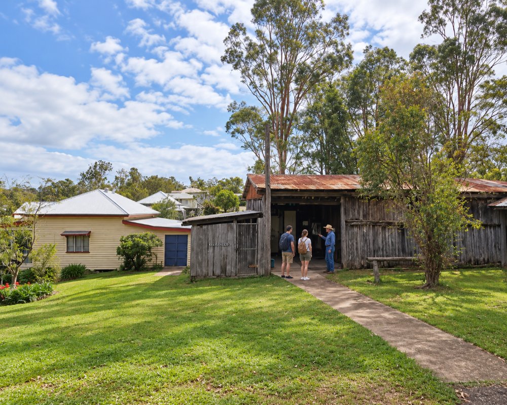
Only a few dozen people live in the township itself, with more on the surrounding properties. There is a pub, a hall, a school, the old sawmill (closed in 2013) and the museum, which locals joke is bigger than the town. The landscape is one of low forested ridges and creek flats, with the granite bluffs of Mount Walsh visible to the west.
Things To Do
Brooweena Historical Village and Museum
Spread over a large block in Smith Crescent, the village has a dozen or so heritage buildings moved here from around the old Woocoo Shire: the original shire office, a post office, the former railway station, a church, a slab dairy and a blacksmith’s shop. Sheds hold a big collection of farm machinery, timber-getting tools, vehicles and household items. The village is run entirely by volunteers and normally opens on the second and fourth Sundays of each month, and at other times for groups by arrangement.
War Memorial Bridge
A few kilometres from town, a small concrete bridge over a creek on the old road was built in 1921 by a local grazing family as a private memorial to nine men of the district who died in the First World War. Monuments at each end carry their names. It is heritage listed and is one of the more unusual war memorials in Queensland. The town also has a conventional memorial, unveiled in 1922.
Mount Walsh National Park
About 40 minutes west, near Biggenden, Mount Walsh rises abruptly from the plain in a mass of granite domes and cliffs. A steep track from the picnic area climbs towards the summit, and the Waterfall Creek rock pools on the park’s eastern side are a popular swimming spot after rain.
Country Drives
Back roads lead south through Gigoomgan and Teebar, two of the earliest pastoral runs in the district, and north to the old gold town of Aramara. Traffic is light and the scenery gentle, though some roads are gravel.
Woocoo war memorials
The district’s First World War digger memorial was first put up in 1922 outside St Mary’s Church at Teebar, south-west of the town, and was moved to the grounds of the Woocoo Historical Museum in Brooweena in 1992 to protect it from vandalism. St Mary’s itself, on the Maryborough-Biggenden Road, was built as a memorial to the Woocoo Shire soldiers killed in that war and still stands with its cemetery. Together with the memorial bridge, they make a short heritage drive.
History
Brooweena lies in the country of the Butchulla and Kabi Kabi peoples. Its name is thought to come from an Aboriginal word for crab or crayfish.
Squatters took up the Teebar and Gigoomgan runs in 1849. The town itself owes its existence to the railway. A branch line was built west from Mungar Junction, near Maryborough, in 1889, and the station here, at first called Teebar, was renamed Brooweena a year later. A school opened in 1904, and in 1915 the town became the seat of the Shire of Woocoo.
Timber was the main industry from 1924, when the first sawmill was built, until the mill closed in 2013. The shire was merged into the Fraser Coast region in 2008, and the railway has long since closed.
Where To Stay
There is almost no accommodation in Brooweena apart from the hotel and a basic camping area for self-contained travellers.
Maryborough, 40 minutes east, has motels, heritage bed and breakfasts and caravan parks, and Biggenden has a small motel and caravan park.
Fraser Coast Regional Council’s nearest free camp is at the Teebar Sports Grounds, at Teebar just south-west of Brooweena. Campers can stay up to seven nights in the designated area, with toilets, showers and unpowered sites, but there are no bins and no drinking water, so carry water and take rubbish away. The Maryborough-Biggenden Road through town is the main sealed route; check conditions before towing on the gravel back roads. In Maryborough, about 49 km east, the showgrounds on the Bruce Highway have low-cost powered and unpowered sites for up to 72 hours (bookings essential), plus a dump point and the region’s only listed water fill.
Self-contained vehicles can also use the free 48-hour Alan and June Brown car park in central Maryborough, with a permit from the visitor centre, and the low-cost site at Maryborough Airport, which has a dump point.
Eat & Drink
The village pub could not be confirmed as trading in 2026, so bring supplies from Maryborough or Biggenden; the museum volunteers usually offer tea and cake on open days. Bring a picnic if you are visiting midweek.
Brooweena has almost nothing to buy, and the town’s pub could not be confirmed as trading now, so plan to be self-sufficient. The Brooweena Historical Village and Museum in Smith Crescent opens on the second and fourth Sunday of each month, from 10 am to 3 pm, and a museum day makes the best time to visit. Bring a picnic for the museum grounds or a creek-side stop on the back roads. Maryborough, about 40 minutes east, has supermarkets, bakeries, cafes and historic pubs, and Biggenden, about 40 minutes west, is the nearest town in the other direction.
Supplies and fuel: none confirmed in Brooweena; fill up in Maryborough or Biggenden before setting out.
Getting There
From Maryborough, take the Maryborough–Biggenden Road west for 49 km, about 40 minutes. Brooweena is roughly 270 km north of Brisbane, around three and a half hours via Gympie.
The road continues west to Biggenden and Gayndah, giving an inland alternative to the Bruce Highway. There is no public transport.
Experiences
- Historic/Heritage
- Rural/Country
- Self-Drive
Popular Activities
- Bush Walking
- Caravan and Camping
- Driving
- National Park
- Sightseeing
About Brooweena
- Locality: Rural locality
- Brooweena Postcode: 4620
- State: Queensland
- Region: Fraser Coast
- Latitude: -25.60322
- Longitude: 152.26257
- Elevation: 115m
- Timezone: Australia/Brisbane
