
Numeralla, NSW
Numeralla is a village of a few hundred people in a river valley 22 km east of Cooma. It stands where the Numeralla and Big Badja rivers meet, and it is very quiet for most of the year.
Known For
- The Numeralla Folk Festival
- River fishing and swimming holes
- Old gold diggings on the Big Badja
Things To Do in Numeralla
Numeralla Folk Festival
The festival is held over the Australia Day long weekend in January. It is free, with free camping by the river, and it has run for about fifty years. Concerts, sessions and dances fill the hall and the grounds around it.
The Rivers
The Numeralla River is fished for trout and has swimming holes that are popular in summer. Gold was found on the Numeralla River in 1858 and on the Big Badja River in 1861, and there is a basic camping and picnic ground near the junction.
Towards Wadbilliga
A gravel road continues east past Countegany to Wadbilliga National Park, where the Cascades camping area is the start of the walk to Tuross Falls. The road can be rough after rain.
The Cascades campground has six free sites (book online for a small fee) for tents and camper trailers, not caravans, and the roads are unsealed and can turn boggy after rain, so check the park alerts first.
Numeralla Hall and the Churches
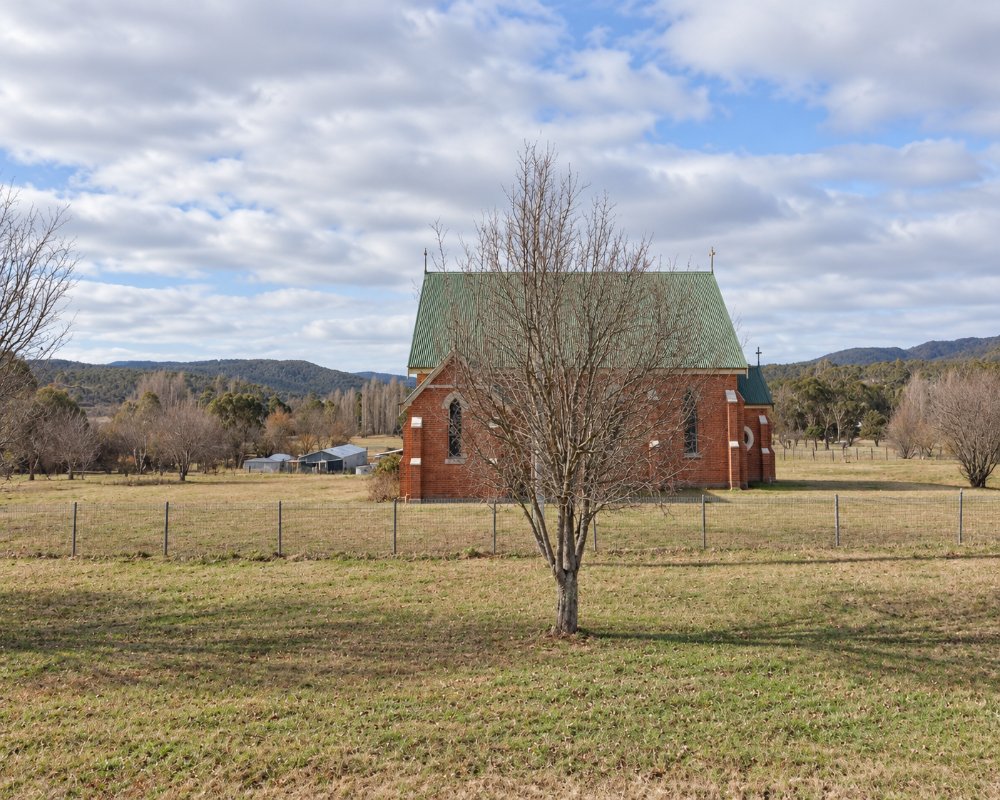
The Diggers Memorial Hall was built as a First World War memorial and opened in May 1922, and it is the heart of the folk festival and the village’s social life. All Saints’ Catholic Church and St John’s Anglican Church stand in the village, and the cemetery is just to the north.
Where To Stay
There is riverside camping, and no hotel or motel. Cooma is 20 minutes away.
The Badja reserve by the river in the village has toilets and is used for picnics and overnight camping, so come self-contained. Over the Australia Day long weekend the folk festival opens free camping grounds at the river junction and the tennis courts, and the village fills up.
Cooma, about 23 km west, has the Cooma Snowy Mountains Tourist Park with powered and unpowered sites, cabins and a dump point, and many motels, and council’s free dump point at Polo Flat, on the eastern edge of Cooma, is open all year and has water. The sealed road from Cooma suits caravans, but beyond the village the roads to Countegany and Wadbilliga are gravel, narrow and slippery in the wet.
Eat & Drink
The village has no shops. Bring supplies from Cooma.
During the folk festival there is food on the festival grounds, but at other times the village is quiet. Cooma has supermarkets, several pubs, bakeries, cafes and service stations, including the truck stop at Polo Flat; fill up with fuel and water there before heading east, as there is no fuel on the Badja and Wadbilliga roads.
The Numeralla Folk Festival runs over the Australia Day long weekend in January and is free to attend. Volunteers run the hall kitchen from about 9am until late with home-cooked meals, and there is a barbecue for late breakfast and lunch, a stocked bar and a market on the Sunday morning.
History
Settlers took up runs in the district in the 1840s; after the gold finds the village site was gazetted in 1863 and proclaimed again in 1885.
Numeralla is in the country of the Ngarigo people. By 1850 the district was part of a squatter’s run called Numarella, and for many years the village was spelt Umaralla; the present spelling was adopted in 1972. By 1866 diggings ran for about three miles along the river, though few miners remained by 1868. The public school opened in 1877 and closed at the end of 2015, and the river flats later grew potatoes for the Monaro and Canberra.
Getting to Numeralla
From Cooma, take Numeralla Road east for 22 km. The road is sealed as far as the village.
From Sydney it is about 400 km by Canberra and Cooma, and from Canberra about 130 km. There is no public transport to the village.
Experiences
- Historic/Heritage
- Rural/Country
- Self-Drive
Popular Activities
- Caravan and Camping
- Driving
- Fishing
- National Park
- Sightseeing
- Swimming
About Numeralla
- Locality: Rural locality
- Numeralla Postcode: 2630
- State: New South Wales
- Region: Snowy Mountains
- Latitude: -36.17722
- Longitude: 149.34067
- Elevation: 774m
- Population: 258
- Median Income: $31356
- Area (Sq/km): 174.615
- Timezone: Australia/Sydney
