
Edith, NSW
Edith is a farming locality about ten kilometres south-east of Oberon, on a plateau close to 1,200 metres above sea level. It is a place of sheep and cattle paddocks, windbreaks of pine and a few scattered homesteads, with no shops or services.
Known For
- High, open grazing country
- On the road to Kanangra Walls
- Cold winters with occasional snow
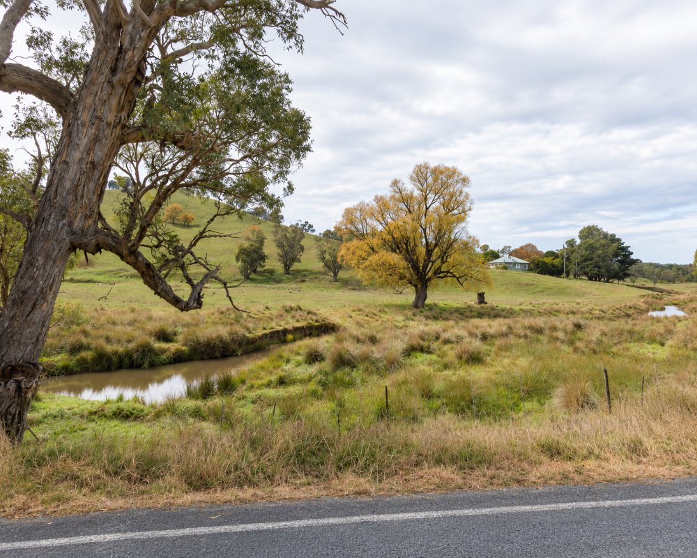
Travellers know Edith mainly as a name on Edith Road, the sealed road that leads south from Oberon towards Kanangra-Boyd National Park and, for now, the only road into Jenolan Caves. About 23 kilometres from Oberon the gravel Kanangra Walls Road turns off for the lookout at Kanangra Walls. Jenolan Caves has been closed since 2024 and is not expected to reopen before early 2027.
Things To Do around Edith
Kanangra Walls
Beyond Edith, the gravel Kanangra Walls Road turns south off Edith Road and runs about 25 km across the Boyd Plateau to the car park at Kanangra Walls. The road suits ordinary cars, and vans towed with care. A level, wheelchair-friendly path leads to the main lookout over the sandstone cliffs, and a short, steep track drops to Kalang Falls.
Mount Werong and the Colong Stock Route
About 8 km out of Oberon, just before Edith, Butter Factory Lane leads south to Shooters Hill Road and on to Mount Werong Road, the old Oberon to Colong stock route by which cattle were once driven through Yerranderie to market at Camden. The National Parks Mount Werong campground, about 10 km into the park, can be reached by 2WD in dry weather; beyond it the route is for four-wheel drives.
Duckmaloi River
The Duckmaloi River crosses the district at Edith and is one of Oberon’s trout streams, open from the October long weekend to the June long weekend. You need a NSW freshwater fishing licence, and much of the river runs through private land, so ask before crossing paddocks.
Jenolan Caves
Edith Road continues about 18 km east to Jenolan Caves, which are closed while the Two Mile road is repaired and are expected to reopen in early 2027. The last 5 km is steep and narrow and is closed to caravans and trailers.
Where To Stay
There are farm stays and cottages in the surrounding district, and Oberon has motels and a caravan park.
Edith itself has no shop, caravan park or campground. A handful of farm stays and cottages in the surrounding district take guests, some of them on working sheep and cattle properties, and most are booked online.
Oberon, about 12 km north-west, is the place to base yourself. The Jenolan Holiday Park in Cunynghame Street has powered and unpowered sites large enough for caravans and fifth-wheelers, cabins, a camp kitchen and a dump point, and the town has the Highlands Motor Inn, the Big Trout Motor Inn and rooms at the Royal Hotel. For camping, the National Parks Boyd River campground in Kanangra-Boyd, about 40 km south-east of Edith, has 10 sites that take caravans, with toilets and wood barbecues and only a booking fee, and the Mount Werong campground suits tents. Don’t take a caravan along Edith Road past the Kanangra Walls Road turn-off, as the last stretch into Jenolan is closed to vans and trailers. Expect frost on most nights from autumn to spring.
Eat & Drink
There is nowhere to eat or buy supplies at Edith, so Oberon, about 12 km north-west, is the place to stock up. The Royal Hotel on Oberon Street, trading since 1881, serves pub meals beside a log fire, and the Oberon RSL Club has its Wok & Grill bistro and a bar. For breakfast, coffee and cakes, try The Milbrey Kitchen & Store in its restored main-street cottage, Peter’s Cafe or Pick of the Bunch, and Oberon Pies and Pastries bakes pies and bread for the road. Oberon has supermarkets and several service stations with diesel. For a longer lunch, the Garden Restaurant at Mayfield Garden is about 10 km north-west of Oberon. Fill up before you leave town: there is no fuel at Edith, at Kanangra-Boyd, at Jenolan or anywhere on the back roads south of Oberon.
RedGround Truffle Farm near Oberon runs truffle hunts with trained dogs and tastings by the fire, and Mayfield’s restaurant serves breakfast and lunch, with a high tea added in 2026.
History
Edith is in Gundungurra country, close to the boundary with the Wiradjuri to the north-west, and its Aboriginal name was Buckemall. Europeans took up land from about 1840, and John McLean Whalan, brother of Charles Whalan of Glyndwr at Oberon, is credited with founding the settlement and its Methodist church. Many of the early families were Protestants from northern Ireland. When a school was proposed, the Anglican minister at O’Connell suggested naming it after the first girl to enrol, Edith Bailey. The school opened in 1884, and the name soon spread to the whole district. Around 1950 a church hall was moved here from Porters Retreat.
Getting to Edith
From Oberon, follow Edith Road south-east. Take fuel and food from town, as there is none beyond it.
Edith Road is sealed and signposted to Jenolan Caves and Kanangra-Boyd from Ross Street in Oberon, and it suits caravans as far as the Kanangra Walls Road turn-off. From Sydney, allow about 3 hours: until Victoria Pass reopens in about mid-2027, go by the Darling Causeway and Lithgow, then Jenolan Caves Road to Hampton, Duckmaloi Road and Titania Road to Edith Road. There is no public transport.
Experiences
- Rural/Country
- Self-Drive
Popular Activities
- Driving
- Fishing - Trout/Fly
- National Park
- Off Road Driving
- Sightseeing
About Edith
- Locality: Rural locality
- Edith Postcode: 2787
- State: New South Wales
- Region: Blue Mountains
- Latitude: -33.80021
- Longitude: 149.92238
- Elevation: 1174m
- Population: 94
- Median Income: $37700
- Area (Sq/km): 62.857
- Timezone: Australia/Sydney
