
Bateau Bay, NSW
Bateau Bay is a residential suburb on the Central Coast, immediately south of The Entrance and Shelly Beach. Visitors come for its small, uncrowded beach and for the southern section of Wyrrabalong National Park, which covers the headlands between here and Forresters Beach.
Known For
- Crackneck Lookout and whale watching
- Clifftop walking in Wyrrabalong National Park
- A quiet beach with rock platforms
Things To Do in Bateau Bay
Crackneck Lookout
A sealed road climbs to this lookout on the park’s highest headland, with a view north over The Entrance and Tuggerah Lake to Norah Head. It is one of the best places on the coast to watch humpback whales from June to November. There are picnic tables and barbecues.
The Coast Walking Track
From the Bateau Bay Beach picnic area a track climbs past the lookout and runs south along the cliffs through heath and coastal forest to Wyrrabalong Lookout and Forresters Beach, about three kilometres each way. Sea eagles and, in season, whales are often seen.
Bateau Bay Beach
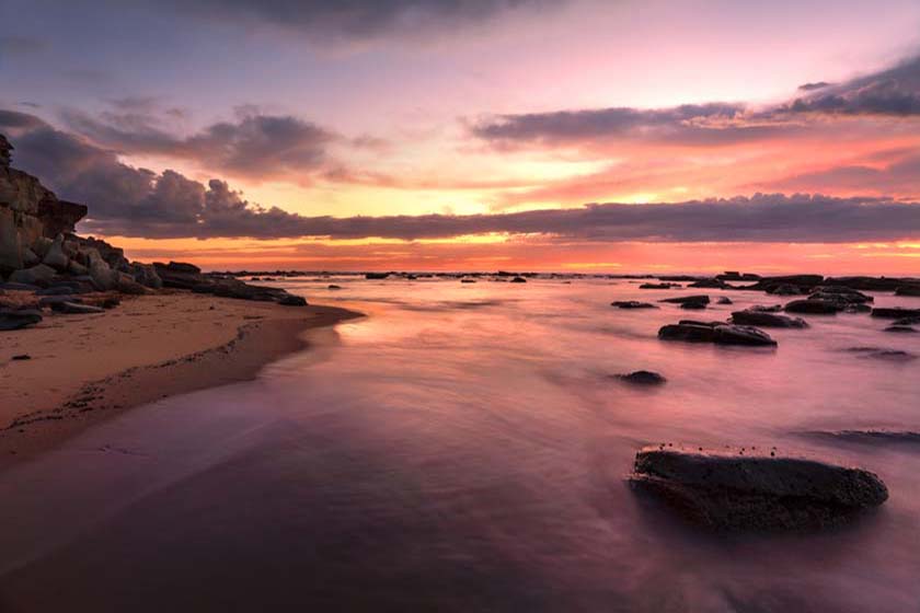
The beach is a short, sheltered curve of sand below the headland, reached from the car park at the end of Reserve Drive. It is not patrolled. Rock platforms at each end are used for fishing and exploring at low tide.
Patrolled Beaches Next Door
Bateau Bay Beach has no patrols, but Shelly Beach and Toowoon Bay, 2 to 3 km north, are both patrolled from late September to late April. Shelly Beach is a surf beach with a surf club cafe and restaurant, and Toowoon Bay is a calmer, sheltered bay with a kiosk under its surf club.
Pelican Time at The Entrance
About 4 km north at Pelican Plaza, The Entrance, volunteers from Marine Wildlife Rescue Central Coast feed the pelicans and talk about them at 3.30pm on Wednesdays, Saturdays, Sundays and public holidays, and daily in the school holidays. The waterfront there has playgrounds and plenty of cafes.
Where To Stay
A large holiday park stands behind the beach, with cabins and camping, and there are motels and apartments nearby.
That park is Blue Lagoon Beach Resort, at 10 Bateau Bay Road, right on the beach with no road to cross. It has powered van and tent sites and cabins from studios to three-bedroom beachfront villas, with a pool and spa, a camp kitchen, a kiosk and a playground, and the Coast walking track starts at its gate. The Quarters, a resort-style hotel, is just south on the highway at Forresters Beach.
NRMA Toowoon Bay Holiday Park, about 3 km north between Shelly Beach and Toowoon Bay, is a council-owned park run by NRMA, with powered and ensuite sites, cabins and a dump point. The Entrance, about 4 km north, has motels and beachfront apartments, and Terrigal, about 10 km south, has hotels and serviced apartments. Book well ahead for summer and the school holidays.
Eat & Drink
Bateau Bay Square, the main shopping centre, has supermarkets, cafes and takeaways. For restaurants and bars, Long Jetty and The Entrance are five minutes away.
Bateau Bay Square on Bay Village Road has Woolworths, Coles, Aldi and Kmart, plus cafes and takeaways, and is the best place on this stretch of coast to stock up. Bateau Bay Bowling Club, part of the Wyong Leagues group, has The Kitchen at the Bay restaurant and a cafe, both open for dine-in and takeaway. The surf clubs at Shelly Beach (Munchas Cafe and The Balcony restaurant) and Toowoon Bay (the Village Kiosk) are 2 to 3 km north. Fuel is on the Central Coast Highway and The Entrance Road.
Bateau Bay Hotel, on the corner of Lumby Drive and The Entrance Road, is the big local pub, with a bistro, Lumby’s Bar, live sport, a bottle shop and a courtesy bus. In the small shopping strip at 103 Bateau Bay Road, Cafe Mocha is a local favourite known for truffle scrambled eggs, buttermilk waffles and a sticky pork belly salad, and next door The Salty Cod topped a 2026 list of the Coast’s best fish and chips with its cod, thick-cut calamari and seafood hot pot; take your parcel down to the beach or up to Crackneck Lookout. The bowling club has a family play area too.
History
Bateau Bay is in the country of the Darkinjung people. For many years the bay was known as Boat Harbour, and when the settlement was declared a village on 13 August 1937 it took the French form of the name (“bateau” means boat). Locals kept using Boat Harbour until the Geographical Names Board discontinued that name in 1975. The suburb grew quickly from the late 1970s: Bateau Bay Public School opened in 1980, the Bay Village shopping centre, now Bateau Bay Square, in 1984, and The Entrance Leagues Club in 1992. The coastal headlands became part of Wyrrabalong National Park in 1991.
Getting to Bateau Bay
Bateau Bay is about 95 kilometres north of Sydney, an hour and a half by the M1 and Wyong Road or the Central Coast Highway. Buses run from Tuggerah and Gosford stations.
Experiences
- Caravan and Camping
- Nature based
- Relaxation
Popular Activities
- Beach
- Bush Walking
- Caravan and Camping
- Fishing - Beach
- National Park
- Surfing
- Swimming
About Bateau Bay
- Locality: Suburb
- Bateau Bay Postcode: 2261
- State: New South Wales
- Region: Central Coast
- Latitude: -33.38121
- Longitude: 151.4791
- Elevation: 23m
- Population: 12146
- Median Income: $30316
- Area (Sq/km): 6.938
- Timezone: Australia/Sydney
Accommodation In Bateau Bay
Discover some of the accommodation in and around Bateau Bay
