
Karloning, WA
Located in Western Australia’s expansive Wheatbelt region, Karloning offers a tranquil escape for those seeking to connect with the rural heart of the state. Situated approximately 320 kilometres northeast by road of Perth, this small locality is a window into the agricultural heritage and natural beauty of the area. The drive from Perth takes about four hours, offering a scenic route through the wide-open spaces and quaint towns that define this part of the country.
Known For
- Expansive stargazing opportunities.
- Proximity to Mukinbudin’s cultural highlights.
- Scenic Wheatbelt landscapes.
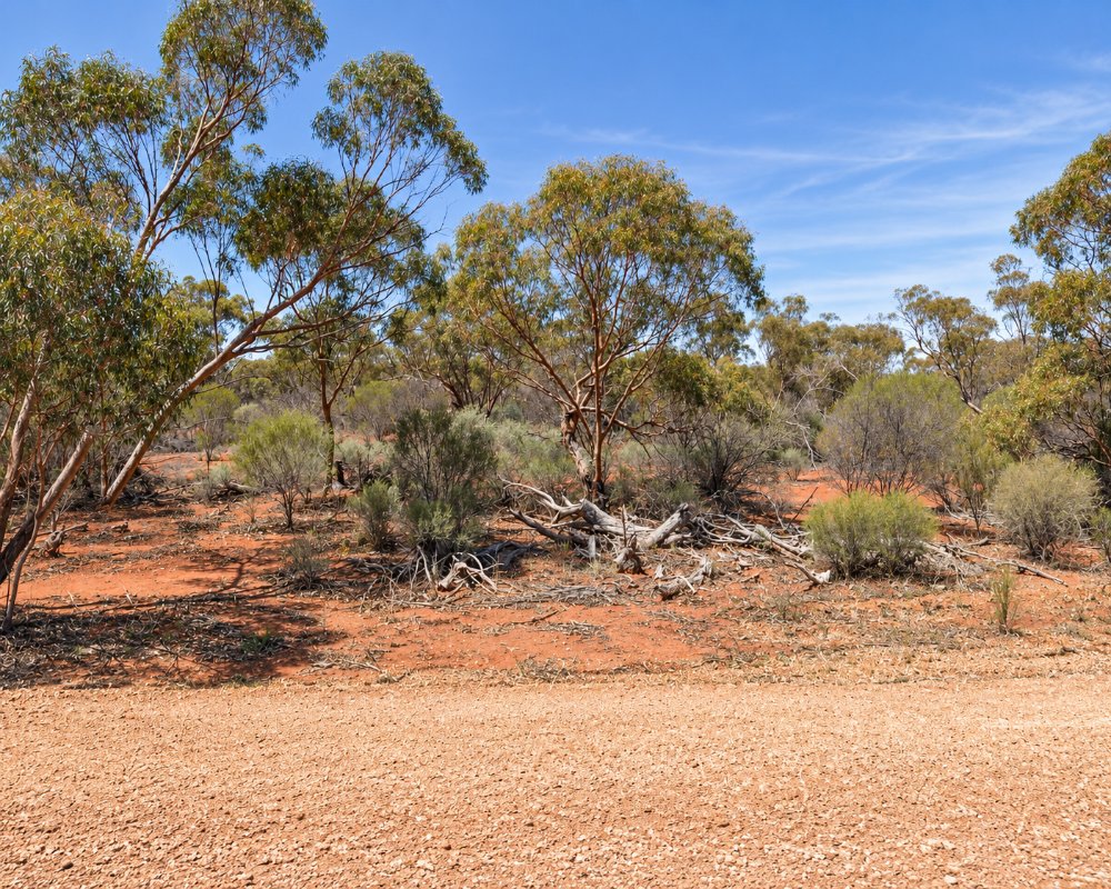
Karloning lies on the Mukinbudin–Wialki Road about 35 km north of Mukinbudin, with Bonnie Rock about 35 km to the north-east. There is no town, shop or fuel, only farms, the Karloning Nature Reserve and 34 residents at the 2021 census, so Mukinbudin is the base.
The community itself is small, giving visitors an intimate glimpse into life in one of Australia’s lesser-populated areas. Despite its size, the locality plays a part in preserving the cultural and natural heritage of the region, with its quiet roads and open spaces offering moments of peaceful reflection.
Things To Do in and around Karloning
Night Skies
While Karloning may not boast an abundance of typical tourist destinations, its appeal lies in its simplicity and the untouched beauty of its surroundings. The area is perfect for stargazers, as the lack of light pollution allows the night sky to shine in full glory. Nearby Mukinbudin offers additional attractions, including historical sites and small-town charm.
Karloning Nature Reserve
This small patch of uncleared bush within the locality is worth a short stop in spring for wildflowers and birds. There are no facilities.
Weira Reserve
Weira Reserve, 13 km east of Mukinbudin, has a limestone breakaway with a gnamma hole, a short bush trail with native orchids and red-capped robins, and barbecue, picnic and camping facilities with a toilet. Climb the breakaway for sunset.
Beringbooding Rock
About 50 km north-east, Beringbooding has Australia’s largest rock-catchment tank, built in 1937, plus a balancing boulder, a large gnamma hole and Aboriginal hand paintings in a cave behind the rock, with free camping and easy caravan access.
Mukinbudin’s Heritage
Outdoor enthusiasts can enjoy leisurely drives through the Wheatbelt, where rolling fields and scattered wildflowers provide a visual feast. For those who prefer more structured activities, Mukinbudin’s community events and markets are an excellent way to engage with locals and explore the produce and crafts of the area.
In Mukinbudin, the Men’s Shed shows machinery from years gone by, a timber-and-iron farm silo built by hand in 1949 has been moved into town and restored, and the old drive-in screen carries a mural of galahs. East of town, a site honours the Lake Brown soldier settlement, which the shire describes as WA’s first large-scale soldier settlement scheme.
Where To Stay
Given its rural setting, Karloning doesn’t have an abundance of accommodation options. Visitors often choose to stay in Mukinbudin, just a short drive away, where options range from cozy bed-and-breakfasts to more modern motels. One popular choice is the Mukinbudin Caravan Park, known for its well-maintained facilities and welcoming atmosphere.
The nearest caravan park is the Shire-run Mukinbudin Caravan Park on Cruickshank Road, about 40 km south, which has powered sites and welcomes dogs on a lead. Fuel up in Mukinbudin, as there are no services in Karloning.
For those seeking a more immersive experience, farm stays in the region offer a chance to connect with the land and its caretakers, providing a unique perspective on the agricultural way of life.
Mukinbudin Caravan Park also has twin-share cabins, self-contained units, restored railway barracks, houses and glamping tents, new ablutions with disabled access, a camp kitchen styled like a shearing shed, a fire pit and a free dump point. The Mukinbudin Hotel on Shadbolt Street has motel rooms across the courtyard and cheaper hotel rooms upstairs.
For free camping, Beringbooding Rock has toilets, tables and fire pits, and Weira Reserve has a toilet and barbecues. Beacon Caravan Park is about 50 km north-west, and Bencubbin Caravan Park, with a dump point, is about 55 km west.
Eat & Drink
Dining opportunities within Karloning are limited, but the surrounding area offers several delightful options. Mukinbudin’s cafes and pubs are a favorite among visitors, with establishments like the Mukinbudin Hotel serving hearty meals in a relaxed environment. Travelers can also stock up on fresh, locally sourced produce from the town’s markets to enjoy picnic-style dining amidst the Wheatbelt’s picturesque landscapes.
For a touch of indulgence, consider sampling regional wines and artisanal goods from the broader Wheatbelt area, which is celebrated for its rich agricultural output and creative community.
In Mukinbudin, the hotel is open every day, with a cafe from early morning for breakfast and takeaway, counter meals at lunch and dinner and brunch on Sundays. The IGA on Shadbolt Street covers groceries and fresh produce, the butcher opens on Saturday mornings, and fuel is from the 24-hour BP card outlet on Strugnell Street. Fill the tank before leaving Mukinbudin, as there is nothing between there and the rocks.
History
Karloning is part of the Shire of Mukinbudin, a region with deep ties to Western Australia’s agricultural development. The locality reflects the broader history of the Wheatbelt, marked by early settler efforts to cultivate the land for farming. These roots are still evident today in the fields and farms surrounding Karloning, where wheat and barley continue to thrive.
Karloning is on the traditional lands of the Kalamaia people. It was never a townsite. The farmland around it opened up after the railway was extended from Bencubbin to Mukinbudin in the early 1920s, and Mukinbudin’s townsite was gazetted on 30 June 1922, taking its name from Muckenbooding Rock. Soldier settlers cleared much of the district under the Lake Brown scheme, and the area was part of the Nungarin Road District until the Mukinbudin Road District was created in 1933.
Getting to Karloning
Karloning is most easily reached by car, with the journey from Perth offering travelers a chance to explore the diverse landscapes of Western Australia. The drive takes approximately four hours, making it an excellent choice for a weekend getaway or a scenic detour on a longer road trip. Public transportation options to Karloning are limited, so visitors are encouraged to plan their route carefully and ensure they have all the necessary supplies for a comfortable journey.
The route runs from Northam through Goomalling, Wyalkatchem, Trayning and Nungarin to Mukinbudin, then 35 km north, or through Koorda and Bencubbin. Main roads are sealed, but check local back roads after rain. The nearest train stop is Merredin.
The road to Karloning is part of the charm, with quiet highways leading to a place where the rush of city life feels worlds away. Along the way, make time to explore nearby attractions or pause to capture the natural beauty that defines this part of the Wheatbelt.
Experiences
- Nature based
- Rural/Country
- Self-Drive
Popular Activities
- Bird Watching
- Caravan and Camping
- Driving
About Karloning
- Locality: Rural locality
- Karloning Postcode: 6479
- State: Western Australia
- Region: Esperance & the Golden Outback
- Latitude: -30.56114
- Longitude: 118.18863
- Elevation: 407m
- Population: 27
- Median Income: $53612
- Area (Sq/km): 213.798
- Timezone: Australia/Perth
