
Kununoppin, WA
Tucked in Western Australia’s Wheatbelt region, Kununoppin is more than just a stop on the map. Situated 257 kilometers northeast of Perth, this small town invites visitors to explore its rich history, unique attractions, and tranquil surroundings.
Known For
- Artistic tin sculptures
- Cooperative Bulk Handling grain facility
- Community-focused events
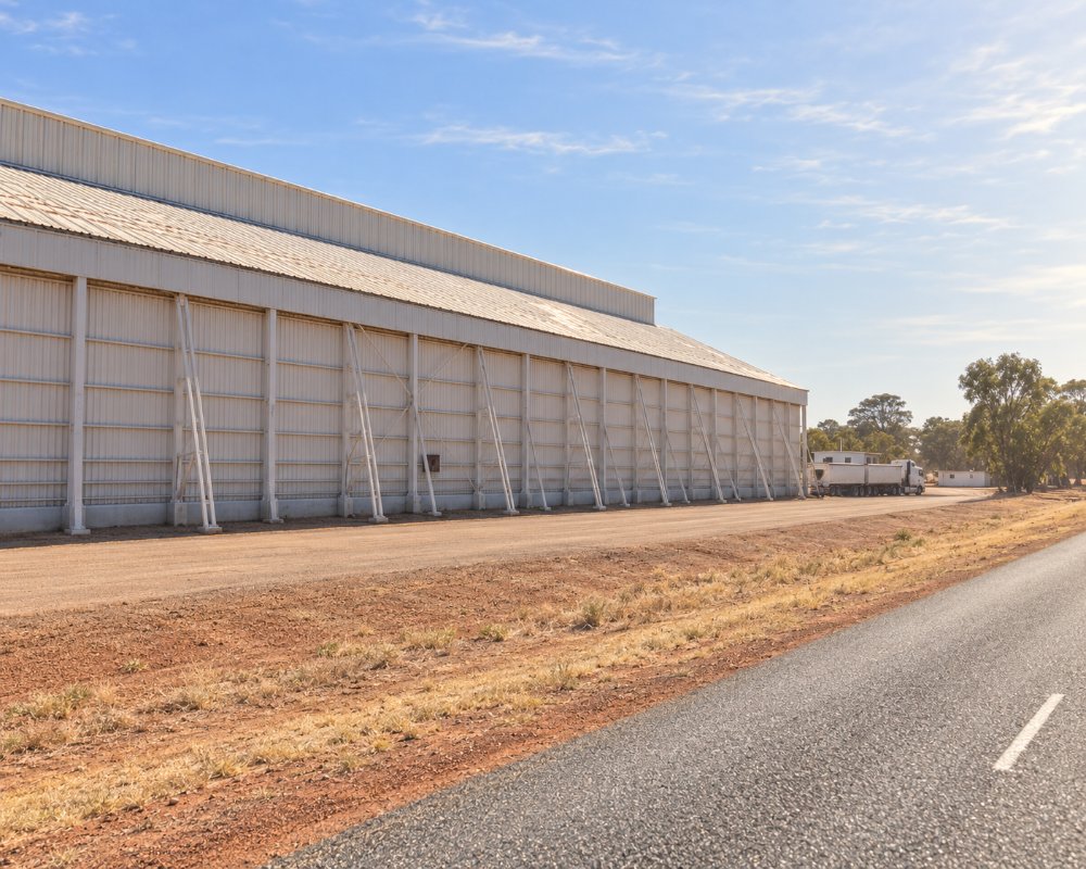
Kununoppin sits on the Nungarin–Wyalkatchem Road, 12 km east of Trayning and about 20 km west of Nungarin, with Merredin about 60 km to the south-east. It has no shop, pub or fuel, so Trayning is the usual base.
Kununoppin is a close-knit community with a population of just 49 residents according to the 2021 census. The town’s demographic leans toward an older age group, with many residents aged between 60 and 69 years. Despite its small size, Kununoppin’s inclusivity shines, with a notable proportion of Indigenous Australians calling it home.
The slower pace of life here is balanced by a vibrant community spirit, where locals come together for events, social gatherings, and day-to-day support. Visitors often remark on the warmth and hospitality of the people they meet.
Things To Do in and around Kununoppin
Tin Sculptures and Heritage Sites
Kununoppin is best known for its artistic tin sculptures, scattered throughout the town. These works of art offer a glimpse into the creative minds of the local community and provide an interactive way to explore the area.
For those interested in history, a stroll through the town reveals many historic sites, including the original railway station and other buildings that date back to its early days.
Salmon Gum Woodlands
Surrounding the town, the Salmon Gum woodlands beckon nature enthusiasts with their serene beauty. Whether you’re an avid photographer or simply seeking a peaceful walk, the natural landscapes around Kununoppin are worth the visit.
Billyacatting Hill Nature Reserve
This 2,500-hectare reserve on the Shire of Trayning’s eastern boundary, just north-east of Kununoppin, is a granite hill in bushland, worth walking in spring for wildflowers, orchids and birds. There are no facilities.
Yarragin Rock and the Gnamma Holes
Yarragin Rock, 24 km north-east of Trayning, is a pair of monoliths on a flat granite outcrop that can be seen from far off. The gnamma holes 18 km north of Trayning hold water after rain and draw birds, with orchids around their edges.
Trayning and Nungarin
Trayning’s Pioneer Park has free gas barbecues and a camp kitchen, and its pool opens from November to March. In Nungarin, the Heritage Machinery and Army Museum fills a huge timber army vehicle workshop built in 1942 and 1943, with military vehicles, a Light Horse collection and farm machinery, and Nungarin’s markets run on the first Sunday of each month from March to December.
Where To Stay
Travelers to Kununoppin can choose from several accommodations in nearby Trayning, such as the Trayning Caravan Park or the Trayning Hotel Motel. Each offers a comfortable base for exploring the region while providing a glimpse into Wheatbelt hospitality.
Trayning Caravan Park, 12 km west on the Bencubbin–Kellerberrin Road, has a dump point, and Trayning has 24-hour card fuel; the Nungarin caravan park to the east is another option.
If you’re looking for something unique, ask about farm stays or rustic lodgings in the surrounding areas—perfect for immersing yourself in the local lifestyle.
The shire-run Trayning Caravan Park on the north side of town has drive-through powered sites, new ablutions, a camp kitchen, a laundry, barbecues and a seasonal fire pit, and dogs are welcome on a lead. The Trayning Hotel Motel on Railway Street has refurbished ensuite rooms, and the shire also lets two furnished cottages on Felgate Parade. Rosevale Homestead, in South Kununoppin, is a renovated farmhouse bed and breakfast with wide verandahs and a wood fire.
Nungarin has a shire caravan park behind the recreation centre, with 31 powered sites, and rooms at the Woolshed Hotel, and Merredin has a tourist park and a free stop for self-contained RVs at Merredin Peak.
Eat & Drink
While Kununoppin itself has limited dining options, the neighboring towns offer delightful spots for a meal or a coffee break. The Trayning Hotel/Motel is a popular choice for both locals and visitors, serving hearty meals in a relaxed setting.
Community events also bring food to the forefront, with local markets and festivals showcasing homemade treats and regional specialties. Keep an eye out for announcements during your visit.
In Trayning, the hotel serves meals from Wednesday to Saturday evenings and a Sunday roast lunch, Hilda May’s Cafe on Mary Street does coffee and toasties on weekend mornings, and the pool kiosk sells cafe food in summer. Fuel is from the BP card outlet on Sutherland Street. In Nungarin, the Woolshed Hotel serves meals and there is card fuel too.
History
Established in 1911 as a railway siding, Kununoppin’s history is deeply intertwined with Western Australia’s agricultural development. The town’s name, derived from the Aboriginal word “Coonoonoppin,” reflects the rich cultural heritage of the area. Its role in the expansion of railways and the introduction of grain elevators in the early 1930s marked a significant step in connecting the region’s farmers to broader markets.
Today, remnants of this history can be seen in the heritage-listed buildings and the stories told by locals. Each structure and artifact carries the legacy of a town that played a pivotal role in the region’s grain production.
Kununoppin is on the traditional lands of the Njaki Njaki Noongar people. The spelling of the name was later changed to fit the Royal Geographical Society’s system for Aboriginal names. In 1923 the local body became the Kununoppin-Trayning Road District, which became the Shire of Trayning-Kununoppin-Yelbeni in 1961 and the Shire of Trayning in 1965. The town had 151 people in 2006.
Getting to Kununoppin
Reaching Kununoppin is a straightforward journey from Perth, taking approximately three hours by car. The scenic drive through Western Australia’s Wheatbelt region offers plenty of opportunities to stop and enjoy the countryside.
The route runs from Northam through Goomalling, Dowerin, Wyalkatchem and Trayning, about 250 km on sealed roads that suit caravans. From Merredin it is about 60 km north-west through Nungarin, and the nearest train stop is Merredin.
For those relying on public transport, options are limited, so planning ahead is essential. Travelers often find that driving is the best way to fully appreciate the journey and explore nearby towns.
Experiences
- Historic/Heritage
- Rural/Country
- Self-Drive
Popular Activities
- Bird Watching
- Bush Walking
- Driving
- Sightseeing
About Kununoppin
- Locality: Rural locality
- Kununoppin Postcode: 6489
- State: Western Australia
- Region: Esperance & the Golden Outback
- Latitude: -31.11282
- Longitude: 117.91889
- Elevation: 297m
- Population: 54
- Median Income: $23660
- Area (Sq/km): 2.667
- Timezone: Australia/Perth
