
Koomberkine, WA
Koomberkine may not be a name that immediately sparks recognition, but this rural locality in Western Australia’s Wheatbelt offers an intriguing escape for those seeking authentic agricultural landscapes and small-town charm. Located about 180 kilometers northeast of Perth, Koomberkine is a two-hour drive from the state capital, making it an accessible yet off-the-beaten-path destination.
Known For
- Agricultural heritage and wheat production
- Proximity to scenic rural landscapes
- Historical connections within the Wheatbelt region
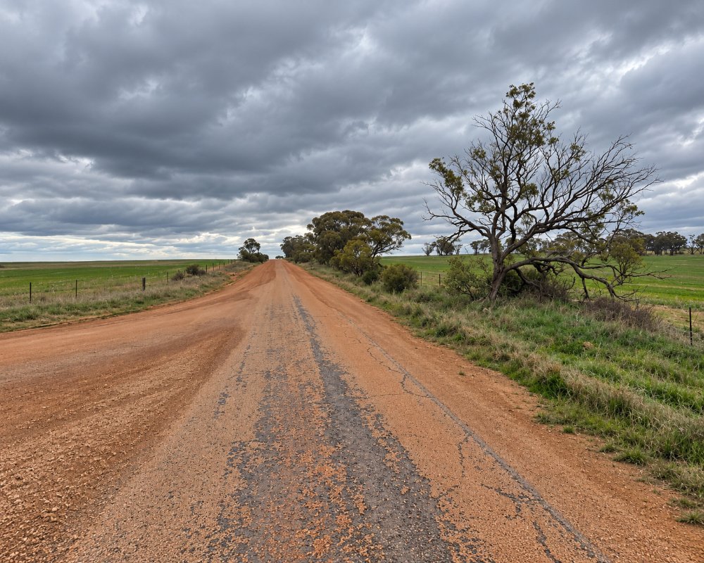
Koomberkine is a farming locality of back roads and wheat paddocks north of Dowerin, about 25 km south of it and 35 km east-south-east of Wongan Hills, with Goomalling roughly 45 km to the south-south-west. There is no shop or fuel, so plan meals and a bed in the towns around it.
The area’s sparse population today adds to its charm, offering a quiet retreat for those interested in exploring its historical significance and rural way of life.
Koomberkine is home to a small population, reflecting the challenges faced by many rural areas in retaining residents. With just a handful of households, it offers a tight-knit community atmosphere. Families living here often have roots that trace back generations, maintaining the traditions of farming and land stewardship.
Children make up a significant proportion of the population, indicative of younger families who choose to remain connected to their agricultural heritage. The town’s simplicity appeals to those seeking an escape from urban density, offering wide-open spaces and a slower pace of life.
Things To Do in and around Koomberkine
While Koomberkine itself may lack conventional tourist attractions, its location within the Wheatbelt makes it a fantastic base for exploring the region. The area offers stunning vistas of golden wheat fields, particularly during harvest season, and opportunities for nature walks in surrounding reserves.
Dowerin Field Days
Nearby towns like Dowerin and Wongan Hills are within a short drive and provide access to events such as the Dowerin Field Days, an iconic agricultural expo that celebrates the region’s farming heritage. The Wongan Hills Nature Reserve is another highlight, featuring a variety of wildflowers and native plants.
The field days are held on the last Wednesday and Thursday of August and draw more than 25,000 visitors, so rooms and van sites across the district book out that week. Caravanners should book well ahead or plan to stay further out.
Tin Dog Creek Walk Trail
Off Redding Road in Dowerin, this creek reserve has a long and a short loop of about 3.3 km and 1.8 km, a bird hide and signs, and it is one of the shire’s wildflower spots from July to October. The Rusty and Rosey tin dog sculptures in town have parking and picnic tables.
Mount O’Brien Lookout
Mount O’Brien, at 424 m the second-highest point in the Wongan Hills, has a lookout with barbecues, shelter and wheelchair access about 10 minutes from Wongan Hills. The summit road is not suitable for caravans, so unhitch in town first.
Lake Ninan
This salt lake, about 11 km south-west of Wongan Hills, is good for sunsets, picnics and stargazing, and for paddling when it holds water. Fully self-contained rigs can stay free for up to 48 hours, but there are no toilets or bins.
Where To Stay
Accommodations in Koomberkine are limited, reflecting its small size and rural setting. However, nearby towns like Dowerin offer a selection of guesthouses, motels, and caravan parks. These locations provide convenient access to Koomberkine while offering more extensive amenities.
The nearest caravan stays are in Dowerin, about 25 km south, and at Wongan Hills Caravan Park to the west, with a free 48-hour rest area and dump point at Minnivale, east of Dowerin. Koomberkine itself has no fuel or shops.
For those seeking an immersive experience, consider farm stays in the surrounding Wheatbelt. These offer an authentic glimpse into the daily life of local farmers and often include activities like feeding livestock or exploring the countryside on guided tours.
In Dowerin, the shire-run Dowerin Short Stay Accommodation and Caravan Park has studio rooms, one-bedroom units and powered caravan sites, the Dowerin Motel and Caravan Park at the roadhouse has self-contained units and van bays, and the Dowerin Commercial Hotel on the main street has traditional pub rooms.
Wongan Hills Caravan Park on Wongan Road is the larger park, with chalets, cabins, studio rooms and concrete powered slabs including drive-through bays, and it fills up in wildflower season. The Minnivale rest area has a toilet, picnic tables and a dump point with a donation box, and Goomalling Caravan Park has grassed sites, ensuite units and a camp kitchen.
Eat & Drink
Given its size, Koomberkine doesn’t boast its own eateries, but the surrounding region has a range of options to suit various tastes. From hearty meals at country pubs to cafes serving freshly baked goods, visitors won’t need to travel far for a satisfying meal.
For a unique dining experience, consider stopping by the Dowerin Bakery, known for its delicious pies and pastries. Alternatively, Wongan Hills offers quaint cafes where you can enjoy a relaxed lunch while soaking up the rural atmosphere.
The Dowerin Bakery bakes bread, pies, pastries and pizza from Monday to Saturday and has tables on the main street. The Dowerin Roadhouse sells fuel, takeaway and coffee every day, the Commercial Hotel does pub meals, and the Dowerin Community Club serves dinner on some nights. In Wongan Hills, the bakery and cafe opens on weekdays, the Wongan Hills Hotel serves meals every day and the IGA is open daily. Fill up with fuel in Dowerin or Wongan Hills.
History
Koomberkine’s history is closely tied to the agricultural boom that defined much of the Wheatbelt region in the 20th century. Settled as part of Western Australia’s push to develop its rural areas, the locality became a hub for grain production, helping to establish the Wheatbelt as the breadbasket of the state.
While the population has declined in recent years, the remnants of its agricultural past can still be seen in its landscapes and infrastructure. Local stories from the region speak to the resilience of its early settlers, who faced the challenges of isolation and arid conditions to create a thriving farming community.
Koomberkine is on Ballardong Noongar country. It was never a townsite and has stayed a rural locality. Settlement around Dowerin began in 1895, and the Dowerin Road District was gazetted on 3 November 1911 as wheat and sheep farming spread across the district. The shire’s population peaked at 1,475 in 1933, and Koomberkine counted 54 residents across about 357 square km in 2021.
Getting to Koomberkine
The easiest way to reach Koomberkine is by car, with a straightforward drive from Perth taking around two hours. The journey itself is part of the experience, with scenic roads winding through the Wheatbelt’s iconic landscapes.
One route is the Great Eastern Highway to Northam, then north through Goomalling to Dowerin and onto local roads. The other is the Great Northern Highway and the Calingiri road to Wongan Hills, then east. The main roads are sealed and suit caravans, but farm roads in the locality are often gravel.
Once in the area, having your own vehicle is essential for exploring. Public transport options are limited, reflecting the locality’s remote nature. However, the sense of adventure in navigating the region’s quiet roads adds to the charm of the experience.
Experiences
- Nature based
- Rural/Country
- Self-Drive
Popular Activities
- Bird Watching
- Bush Walking
- Caravan and Camping
- Driving
About Koomberkine
- Locality: Rural locality
- Koomberkine Postcode: 6461
- State: Western Australia
- Region: Esperance & the Golden Outback
- Latitude: -30.96833
- Longitude: 116.96667
- Elevation: 346m
- Population: 64
- Median Income: $34788
- Area (Sq/km): 356.922
- Timezone: Australia/Perth
