
Jitarning, WA
Located in the heart of Western Australia’s Wheatbelt, Jitarning is a quiet locality steeped in history and surrounded by the vast beauty of rural landscapes. Just over 250 kilometers southeast of Perth, this small town offers visitors a chance to experience the authentic charm of Western Australia’s countryside.
Known For
- Historic Jitarning Hall
- Agricultural Heritage
- Proximity to Kulin’s iconic attractions
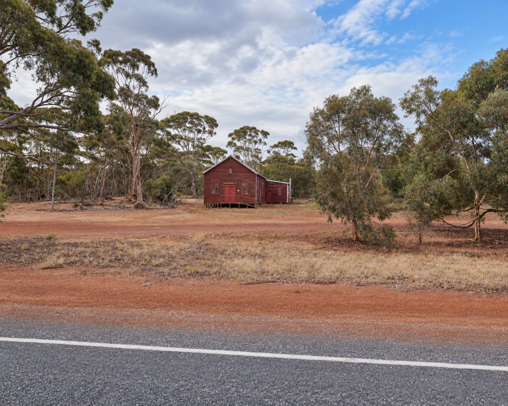
Jitarning sits on the Williams–Kondinin Road in the Shire of Kulin, about 22 km south-west of Kulin and 15 km north-east of Dudinin. The hall and an old hostel are its landmarks, with farms all around, and it makes a short stop on the drive between Narrogin and the granite country further east.
Jitarning remains a small and close-knit community, with a population of just 63 residents as of the 2021 Census. The town is characterized by its quiet streets and open spaces, where the pace of life is slow and unhurried. The surrounding Wheatbelt landscape is dotted with farms that continue to be the backbone of the local economy.
Things To Do in and around Jitarning
Jitarning Hall
Jitarning Hall remains a key point of interest for those wanting to connect with the town’s heritage. Additionally, the surrounding area offers natural and cultural attractions that capture the essence of the Wheatbelt.
Jitarning Hostel
Across from the hall stands a 1918 building put up as Jitarning’s hotel. It never got a liquor licence, because the Kulin Hotel already held one, so it served instead as a hostel for wheat lumpers, itinerant workers and the school teacher. That refusal is often given as the reason Kulin grew and Jitarning did not. It is now a private home, so view it from the road.
Kulin and the Tin Horse Highway
Just a short drive north-east, Kulin is home to iconic landmarks such as the Tin Horse Highway—a quirky and creative display of tin sculptures along the roads. Travelers also enjoy the annual Wildflower Season, where the countryside bursts into a vibrant tapestry of colors.
For those visiting, the nearby town of Kulin offers more amenities, including dining options and accommodation. Visitors often enjoy exploring the broader Shire of Kulin, known for its friendly communities and vibrant events like the Kulin Bush Races.
Buckley’s Breakaway
East of Kulin, Buckley’s Breakaway is a set of eroded, colourful breakaways, a change from the usual granite rocks. Go late in the afternoon for the best colours, and keep back from the crumbly edges.
Kulin Water Slide
On hot days, Kulin’s giant water slide and pool, opposite the caravan park on Johnston Street, are a welcome break. They open in the warmer months.
Holt Rock
Further east on the road to Hyden, Holt Rock is another big granite outcrop and makes a quiet detour on the way to Wave Rock.
Where To Stay
Accommodations are scarce within Jitarning itself, but the welcoming towns nearby, like Kulin, provide comfortable places to stay. From cozy bed-and-breakfasts to self-contained cottages, options cater to a range of travelers looking to explore the Wheatbelt’s unique offerings.
Kulin, about 20 km north-east, has the Kulin Caravan Park, a free 72-hour RV area and 24-hour card fuel, so it makes the easiest base for caravanners.
Jitarning itself has no accommodation or camping. Kulin Caravan Park on Johnston Street has 11 powered bays, five of them drive-through, plus tent sites, and it is pet friendly. Fully self-contained RVs can stay free for up to 72 hours in the Discovery Zone between the railway and Johnston Street, behind the public toilets, with a free dump point and drinking water nearby. Camping is also allowed at Jilakin Rock, about 15 km east of Kulin.
For a bed, Kulin has rooms at the Kulin Community Hub, Wisteria House bed and breakfast, and self-contained cottages and units. To the south-west, Harrismith Caravan Park takes self-contained vans only.
Eat & Drink
Jitarning has no shop, fuel or pub, so head to Kulin, 22 km north-east. Acres of Taste on Johnston Street is the daytime stop for coffee and lunch on weekdays, and the Kulin Community Hub, also on Johnston Street, is the town’s pub, open every day from the afternoon and from late morning at weekends.
Kulin’s 24-hour fuel facility sells unleaded and diesel by card only, and the Kulin Community Resource Centre on Johnston Street is the place for local information on weekdays.
History
Jitarning owes much of its early development to its agricultural roots. Settlers were drawn to the area by its fertile soil and reliable water sources, including the renowned Jitarning Soak. The Merredin to Yilliminning railway line, constructed in the early 20th century, played a pivotal role in connecting Jitarning to neighboring towns and fostering its growth.
At the heart of Jitarning’s community life is the historic Jitarning Hall, built in 1918. This hall stands as a testament to the town’s enduring spirit, serving as a gathering place for celebrations, school events, and community meetings over the decades. Its architecture, evocative of a bygone era, provides a glimpse into the lifestyle and culture of early settlers in the Wheatbelt.
Jitarning lies in Ballardong Noongar country, and the name comes from the Geetaring soak, a reliable water source. Michael Brown, who founded the Narrogin Road Board and the Narrogin flour mills, set up a pastoral base camp at the soak, and more settlers followed. The town was gazetted in 1917. The hall opened on 5 October 1918 to welcome soldiers home from the First World War, and a supper room, stage and bigger dance floor were added in 1924.
Getting to Jitarning
Jitarning is best accessed by car, with a scenic drive of approximately three hours from Perth. The route takes visitors through the Wheatbelt’s iconic landscapes, featuring rolling fields, native bushland, and expansive horizons. Public transport options are limited, making a road trip the most practical and rewarding way to experience the journey.
From Perth, follow the Brookton Highway to Corrigin and then head south-east to Kulin, about 280 km, and Jitarning is 22 km south-west on the Williams–Kondinin Road. You can also go via Pingelly, Wickepin and Harrismith. Allow about three and a quarter hours on sealed roads that suit caravans. Transwa’s Perth to Esperance coach stops at Kulin.
Experiences
- Historic/Heritage
- Rural/Country
- Self-Drive
Popular Activities
- Driving
- Sightseeing
- Swimming
About Jitarning
- Locality: Rural locality
- Jitarning Postcode: 6365
- State: Western Australia
- Region: Esperance & the Golden Outback
- Latitude: -32.78624
- Longitude: 117.99864
- Elevation: 341m
- Population: 41
- Median Income: $47788
- Area (Sq/km): 440.381
- Timezone: Australia/Perth
