
Miriam Vale, QLD
Miriam Vale is a small town on the Bruce Highway, about 70 kilometres south of Gladstone and 150 kilometres north of Bundaberg. Most people know it for two things: the turn-off to Agnes Water and the Town of 1770, and the mud crab sandwiches sold at the roadhouse.
Known For
- Mud crab sandwiches
- The turn-off to Agnes Water and 1770
- Rainforest at Bulburin
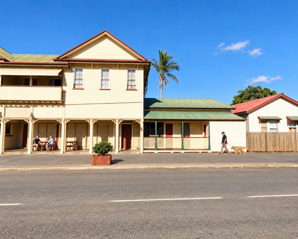
About 500 people live here. The town has a pub, a couple of cafes, one of which doubles as a tourist information hub with Discovery Coast brochures, and it is a sensible place to break the drive.
Things To Do in Miriam Vale
Try a crab sandwich
The roadhouse on the highway has sold fresh mud crab sandwiches for decades and they have become a minor institution among Bruce Highway travellers. They are not cheap, and they sell out.
Bulburin National Park
In the ranges south-west of town, Bulburin protects one of the largest remaining areas of subtropical rainforest in central Queensland, with a bush camping area and a short walk to a lookout. The gravel road is steep in places and best in dry weather.
Mount Colosseum
This small national park a few kilometres south has no facilities and no formed track, only a steep scramble to a rocky summit for experienced walkers.
The Big Fig and the war memorial
Beside the railway station on Station Street, a huge fig tree marks the spot where dairy farmers once left their cream cans for the truck to the Port Curtis Dairy in Gladstone. The Big Fig is on the Queensland Heritage Register, as is the war memorial on Blomfield Street, unveiled in December 1921. Both are a short walk from the highway and make an easy leg-stretch.
Monthly community market
A community market sets up next to the Miriam Vale Hotel on the first Sunday of each month, from about 8 am until midday. It is a small local affair, but it fits neatly into a morning drive to or from Agnes Water.
Where To Stay
There is a hotel, a motel and a caravan park. Most visitors drive on to Agnes Water, 57 kilometres away.
RV travellers can pull in at Lions Park, one of the council’s RV-friendly stops; check the signs for the current time limit. The council dump point is on the corner of Blomfield and Dougall streets, a block from the highway, and has a drinking-water tap, although it is not signposted.
For bush camping, Bulburin National Park, about 40 km south-west, has three QPWS camping areas: Old Forestry, Zamia and Range View. All need a camping permit booked in advance, and the roads in are steep gravel that QPWS closes after heavy rain. Range View and the 4WD loop road have been closed since December 2024, so check the park alerts before you set out, and leave big vans in town.
For the coast, Agnes Water is 57 km east on the sealed Fingerboard Road and has the region’s widest spread of caravan parks, resorts and holiday units. About 100 km to the south-east, BIG4 Rules Beach Holiday Park has powered sites, cabins and glamping tents behind a quiet ocean beach. Gladstone, 70 km north, has the most motels and caravan parks.
Eat & Drink
Beyond the roadhouse, the Miriam Vale Hotel serves counter meals and there are cafes in the main street.
The Big Crab, the giant crab perched above the Shell service station on the Bruce Highway, is the stop most travellers know. Its crab sandwiches are fresh mud crab on buttered white bread, and the counter also turns out prawn, barramundi, crocodile and fish burgers, plus fish and chips. The Miriam Vale Hotel on Blomfield Street is the town pub, known for steaks and pub classics, a good range of gluten-free dishes and local seafood. Cool Beans Cafe is the place for a coffee, and it doubles as the town’s tourist information hub, with maps and brochures for the Discovery Coast. On the first Sunday morning of each month, a community market runs beside the hotel.
Fuel is on the highway, including at the Shell under the Big Crab. Shopping in Miriam Vale is small-town only, so stock up at the supermarkets in Gladstone or Agnes Water before a longer stay.
History
This is Gooreng Gooreng country. The town takes its name from a cattle station established in the 1850s and grew as a railway and dairying centre. It was the seat of Miriam Vale Shire until council mergers in 2008.
Getting to Miriam Vale
Miriam Vale is on the Bruce Highway, about 50 minutes south of Gladstone. Bororen is the next township to the north. The Spirit of Queensland stops at the station, and the Tilt Train stops only when a seat to or from Miriam Vale is booked ahead.
Experiences
- 18-35's
- Caravan and Camping
- Rural/Country
- Self-Drive
Popular Activities
- Bush Walking
- Caravan and Camping
- City Sightseeing
- Driving
- Fishing
- Golfing
- Horse Riding
- National Park
- Off Road Driving
- Sightseeing
About Miriam Vale
- Locality: Urban locality
- Miriam Vale Postcode: 4677
- State: Queensland
- Region: Gladstone
- Latitude: -24.32865
- Longitude: 151.56059
- Elevation: 63m
- Population: 512
- Median Income: $26104
- Area (Sq/km): 43.589
- Timezone: Australia/Brisbane
