
Taroom, QLD
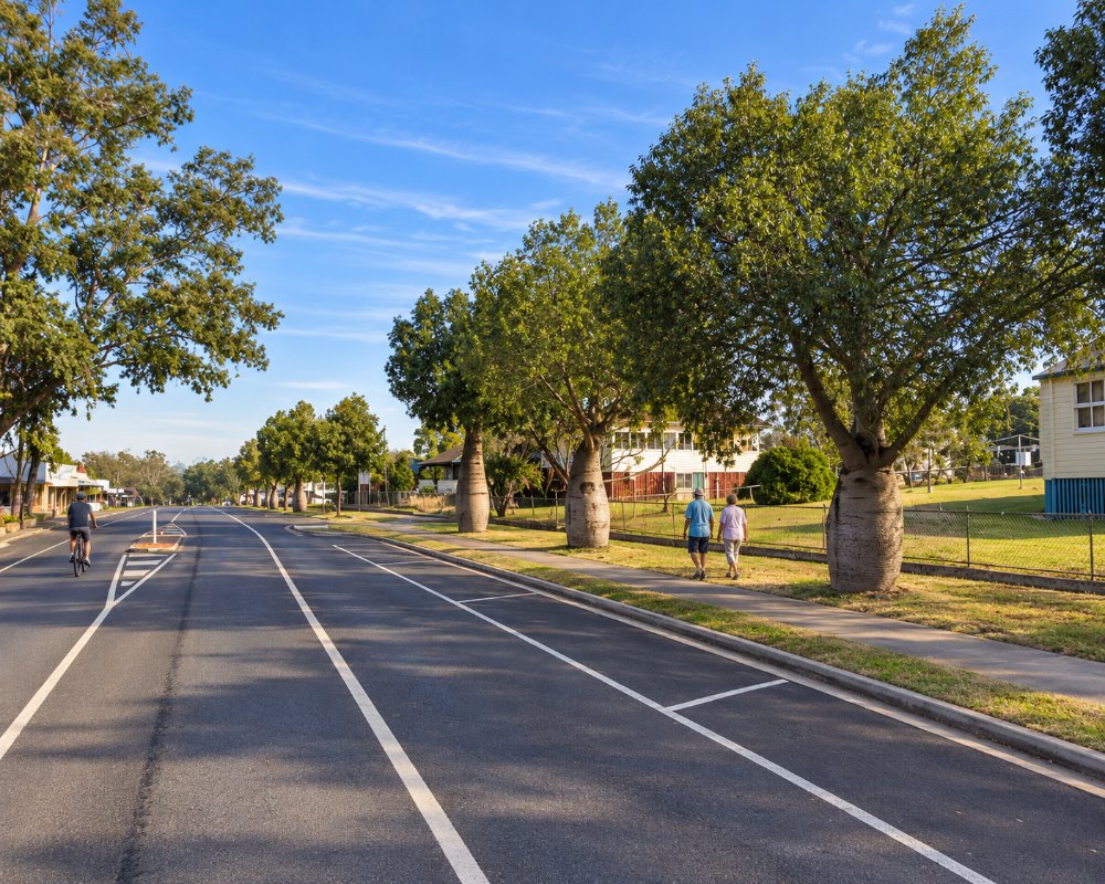
Taroom is a town of about 870 people on the Dawson River, where the Leichhardt Highway crosses it, about 100 km south of Theodore and 60 km north of Wandoan. It is cattle country, with sandstone ranges and national parks to the north and west.
Known For
- The Leichhardt Tree
- The Dawson River and its fan palms
- Sandstone national parks nearby
Things To Do in Taroom
The Leichhardt Tree
A coolabah in the main street, thought to be about 300 years old, was blazed by the explorer Ludwig Leichhardt in 1844 on his journey to Port Essington. The carving was lost when an attempt to cut back the bark growing over it removed the initials too, but the tree is still healthy and a plaque tells the story.
Taroom Museum
The museum, at 17 Kelman Street, has a good collection on the pastoral history of the district and opens by appointment.
The Dawson River
The river is lined with tall Dawson River fan palms, which grow wild only in this region. Chain Lagoons and the riverbank near town are good for birds, and Glebe Weir, 50 kilometres north-east, has camping and fishing for saratoga and yellowbelly.
National parks
Isla Gorge National Park, 55 kilometres north, has a lookout just off the highway. Lake Murphy Conservation Park is a quiet seasonal lake with a bush camp, and the Robinson Gorge section of Expedition National Park is a four-wheel-drive trip to the north-west.
Gilbert’s Lookout and Leichhardt Park
A short walk up the hill at the top of Kelman Street leads to Gilbert’s Lookout, named after John Gilbert, the naturalist on Leichhardt’s 1844 expedition, with a memorial and an undercover picnic area looking over the town and the Dawson River. Leichhardt Park on Yaldwyn Street holds the explorer’s memorial and is planted with native trees, apart from a single Aleppo pine grown from seed of the Lone Pine at Gallipoli.
Steel Wings windmill and the Star of Taroom
At the northern entry to town stands a Steel Wings windmill, made in North Sydney between 1907 and 1911 and one of only two of its kind known to still work, with the fan spinning inside a pivoting frame. At the museum, the Iman Wardingarri Keeping Place holds the Star of Taroom, a 160 kg grinding stone with six star-like grooves where Iman people sharpened axes and spears; it was returned to Country in 2021 after decades in a Brisbane backyard.
Taroom’s calendar
The Taroom Show is held in May, and the annual rodeo and campdraft at the showgrounds runs in the cooler months (late June in 2026). September brings the Arts Show and the Taroom Cup races, and the year ends with a Christmas street party and the Christmas races. Campers can often stay cheaply at the showgrounds during events; ask the organisers or the visitor information centre.
Where To Stay
Taroom has a couple of motels, a hotel and a caravan park.
Taroom has a commercial caravan park with powered sites, but it also houses workers, so book ahead in busy periods. Several low-cost bush camps listed by the council are close by. Chain Lagoons, 15 km north off the Leichhardt Highway and 1.1 km down Chain Lagoons Road, is a free camp with 10 level, mostly shaded sites and no facilities; take your rubbish out. Glebe Weir, 54 km away, has 20 unpowered and four powered sites on grass sloping to the river, with toilets, hot showers and fireplaces, paid by honesty box.
Lake Murphy Conservation Park, 31 km north-west, has shady national park sites (permit required) and is reachable by any vehicle in dry weather. Self-sufficient anglers also camp at the Sandy Creek bridge on Juandah Creek, about 5 km south on the Roma-Taroom Road. Isla Gorge’s camping area, 55 km north, takes caravans in dry weather. The town dump point is at 4 Wolsey Street, near the council depot.
Eat & Drink
The Leichhardt Hotel serves meals, and there is a bakery and cafes in the main street.
Taroom’s shops are spread along Yaldwyn Street, which is also the Leichhardt Highway, and Dawson Street, so it is easy to pull in with a van and stock up. The town’s only pub, on Dawson Street, serves counter meals and has a bottle shop and motel rooms, and the main street has a bakery and a café for coffee, pies and lunch on the road. Check opening hours before you go, as some places close early or on weekends. Leichhardt Park and Gilbert’s Lookout make good picnic stops, and the Dawson River bridge on the edge of town is a local fishing spot.
For a larger choice, Theodore, 100 km north, has the Hotel Theodore on The Boulevard, serving lunch and dinner. Taroom has a supermarket and fuel; fill up here before heading out to Expedition National Park, Glebe Weir or Lake Murphy, as there are no supplies beyond town. The visitor information centre at 10 Yaldwyn Street can advise on current trading hours.
History
This is the country of the Iman people. Taroom Station was taken up in 1845, soon after Leichhardt passed, and the town grew at the river crossing. The frontier here was violent, and the killing of settlers at Hornet Bank station in 1857 was followed by widespread reprisals against the Iman.
Getting to Taroom
Taroom is on the Leichhardt Highway, an hour south of Theodore and 45 minutes north of Wandoan.
Experiences
- Caravan and Camping
- Environmental
- Farm/Station
- Historic/Heritage
- Nature based
- Remote
- Rural/Country
- Self-Drive
Popular Activities
- Adventure
- Bird Watching
- Bush Walking
- Canoeing
- Caravan and Camping
- Cycling
- Driving
- Fishing
- Fishing - Estuary
- Fossicking
- Golfing
- Horse Riding
- Mountain Biking
- National Park
- Off Road Driving
- Outback
- Shopping
- Sightseeing
- Skiing - Water
- Swimming
- Trail bike riding
- Wildlife
About Taroom
- Locality: Urban locality
- Taroom Postcode: 4420
- State: Queensland
- Region: Capricorn
- Latitude: -25.64043
- Longitude: 149.79848
- Elevation: 202m
- Population: 869
- Median Income: $33592
- Area (Sq/km): 1381.55
- Timezone: Australia/Brisbane
